The ancient sites of New Hampshire are the archaeological and historic places that record roughly 12,500 years of human occupation in the north-eastern United States, from Ice Age hunting camps in the White Mountains to colonial forts raised on the Connecticut River in the 18th century. The oldest of them, the Potter Site in Randolph, was in use between 12,500 and 10,500 B.P., when Paleoindian bands followed caribou herds through the mountain passes. That makes New Hampshire’s deep past more than ten times older than anything standing in Portsmouth’s celebrated historic district. This guide covers both layers: the Paleoindian archaeology that rarely makes the tourist brochures, and the colonial and 19th-century landmarks that do.
The Potter Site: 12,500 Years on a Randolph Terrace
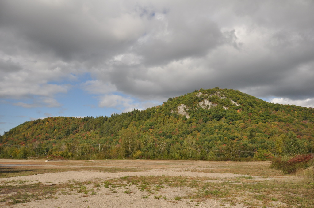
The eight-acre Potter Site in Randolph is the benchmark for New Hampshire’s deep past, and the US Secretary of the Interior has added it to the National Register of Historic Places. What makes it unusual is its purity: it is an exclusively Paleoindian site, undisturbed by later occupation, used intermittently as a seasonal hunting and fishing camp between 12,500 and 10,500 B.P.
Excavation mapped three household encampments spread across the terrace, alongside three stone-tool production workshops, a wooden-tool workshop and three activity areas of undetermined function — all within a few feet of one another. The elevated ground gave clear sightlines for spotting caribou herds moving through the mountain passes, and the herds supplied nearly everything: meat, hide for clothing and tents, bone and antler for tools. Crucially, some of the stone recovered at Potter does not occur naturally nearby, which tells archaeologists these were not isolated bands but nodes in a settlement system reaching across the region. Those findings were published by the New Hampshire Division of Historical Resources at the time of the National Register listing; for wider context on how the state’s archaeology has been pieced together, see New Hampshire Magazine’s survey of archaeology in the state.
The Israel River Complex
Potter belongs to a wider cluster. The Israel River Complex in nearby Jefferson produced the first confirmed Paleoindian sites in northern New Hampshire and remains among the largest known in New England. Both Jefferson and Berlin sit on east–west routes linking the eastward-flowing Androscoggin to the southward-flowing Connecticut — the corridors these groups actually moved along. The pattern is regional rather than local: a comparable 12,500-year-old camp was excavated ahead of bridge works on Connecticut’s Farmington River, yielding roughly 15,000 artefacts, a fire pit and postholes, and the wider North American context is summarised by World History Encyclopedia.
Tenant Swamp: The Oldest Known Dwellings in New England
In 2009, routine archaeological permitting for a new middle school in Keene turned into one of the most important digs in the Northeast. On a sandy terrace overlooking Tenant Swamp, a team led by Robert Goodby of Franklin Pierce University uncovered the remains of four separate households roughly 12,000 years old — the oldest known dwellings anywhere in New England.
The stone told the story of a continental-scale network. The toolmakers at Tenant Swamp used rhyolite from northern New Hampshire and chert from the Munsungun Lakes region of north-central Maine, a source several hundred miles away. That combination is diagnostic of the Paleoindian period, conventionally dated in the Northeast to between about 13,000 and 10,000 years before present, and it shows that social and exchange links stretched far beyond the Connecticut River valley.
The Swanzey Fish Dam
Southwestern New Hampshire holds later Native engineering too. The Swanzey Fish Dam, a large stone V built across the Ashuelot River, is one of the biggest surviving pre-contact stone structures in the region — a piece of fishing infrastructure rather than ceremony.
Mount Jasper: A Native Mine Tunnelled Into a Mountain
Above the city of Berlin, a mile and a half northwest of where the Dead River meets the Androscoggin, Mount Jasper rises to 1,584 feet. Its bands of rhyolite made it one of the most important toolstone sources in the Northeast, and the way it was worked makes it close to unique.
Most quarrying in eastern North America took surface outcrops. At Mount Jasper, Native miners followed the seams underground, cutting a shaft roughly 9 metres (30 feet) deep — one of the only known instances of true pre-contact mining in the eastern United States. Workshop scatters survive at both the summit and the river-facing base, and tools made from Mount Jasper rhyolite have been recovered at sites across the northeastern states. Investigations in the 1980s established use of the source going back as much as 9,000 years, and the 38.5-acre site was listed on the National Register on 29 May 1992. The Mount Jasper Lithic Source record summarises the archaeology.
Is America’s Stonehenge Really an Ancient Site?
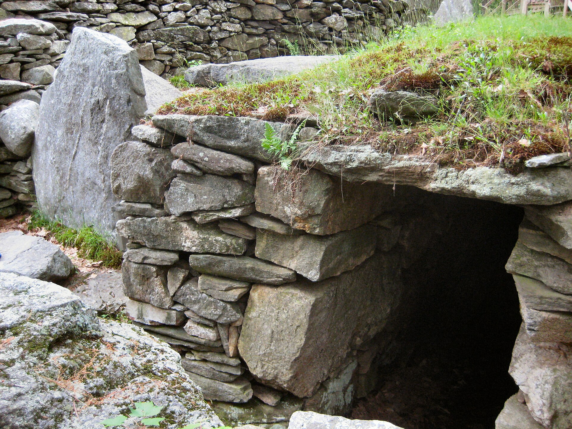
Salem’s America’s Stonehenge is the New Hampshire site most people have heard of, and it is the one most often misdescribed. The 30-acre jumble of chambers, walls and standing slabs has been claimed for Bronze Age Europeans, Phoenicians and Irish Culdee monks. The archaeological verdict is far more prosaic.
The place appears in print as early as the 1907 History of Salem, N.H., described simply as “Jonathan Pattee’s Cave” — Pattee being a settler who lived on the land from the 1820s. Many of the stones carry drill marks post-dating the 1830s, evidence of ordinary quarrying. The much-publicised “sacrificial stone” with its channelled groove closely matches the lye-leaching stones found on countless New England farms, used to draw lye from wood ash for soap-making. No unambiguous pre-Columbian European artefact has ever been recovered there. Archaeologist David Starbuck notes it is widely believed that William Goodwin, the insurance executive who bought the property in 1937 and was convinced of an Irish-monk origin, “created” much of what visitors see today.
None of this makes the hill empty of genuine antiquity. Radiocarbon dates from charcoal on the site run from roughly 2000 BC to 173 BC, and a 1995 excavation in the visitor-centre parking lot uncovered a Native American lodge with multiple hearths. That is a real Late Archaic to Early Woodland Indigenous presence — it simply is not a European megalithic observatory. The site was renamed from Mystery Hill to “America’s Stonehenge” in 1982. Background and the full radiocarbon table are collected on the America’s Stonehenge entry.
Endicott Rock and the Fishing Village of Aquedoctan
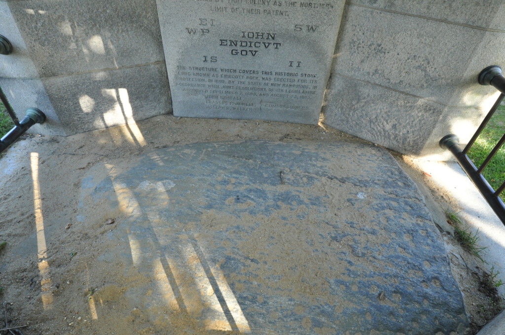
At the outlet of Lake Winnipesaukee at Weirs Beach sits a glacial boulder inscribed on 1 August 1652 by a Massachusetts Bay Colony survey party marking the colony’s northern boundary. It carries the name of Governor John Endicott together with the initials of commissioners Edward Johnson and Simon Willard and surveyors John Sherman and Jonathan Ince — the first documented European exploration of the region.
The colonists did not stumble on the spot. They were led there. The Abenaki of the Penacook built fish weirs in the channel to trap shad running between Winnipesaukee and the Merrimack, and their village here was called Aquedoctan, “place of good fishing” — the origin of the modern name Weirs Beach. Recent reassessment of the boulder has noted the cupules pecked into its surface: pre-contact Native rock art on the same stone the surveyors later signed. The inscription and the protective stone canopy now built over it are documented in the Endicott Rock record.
Colonial Landmarks: Number 4, Portsmouth and the Royal Governor
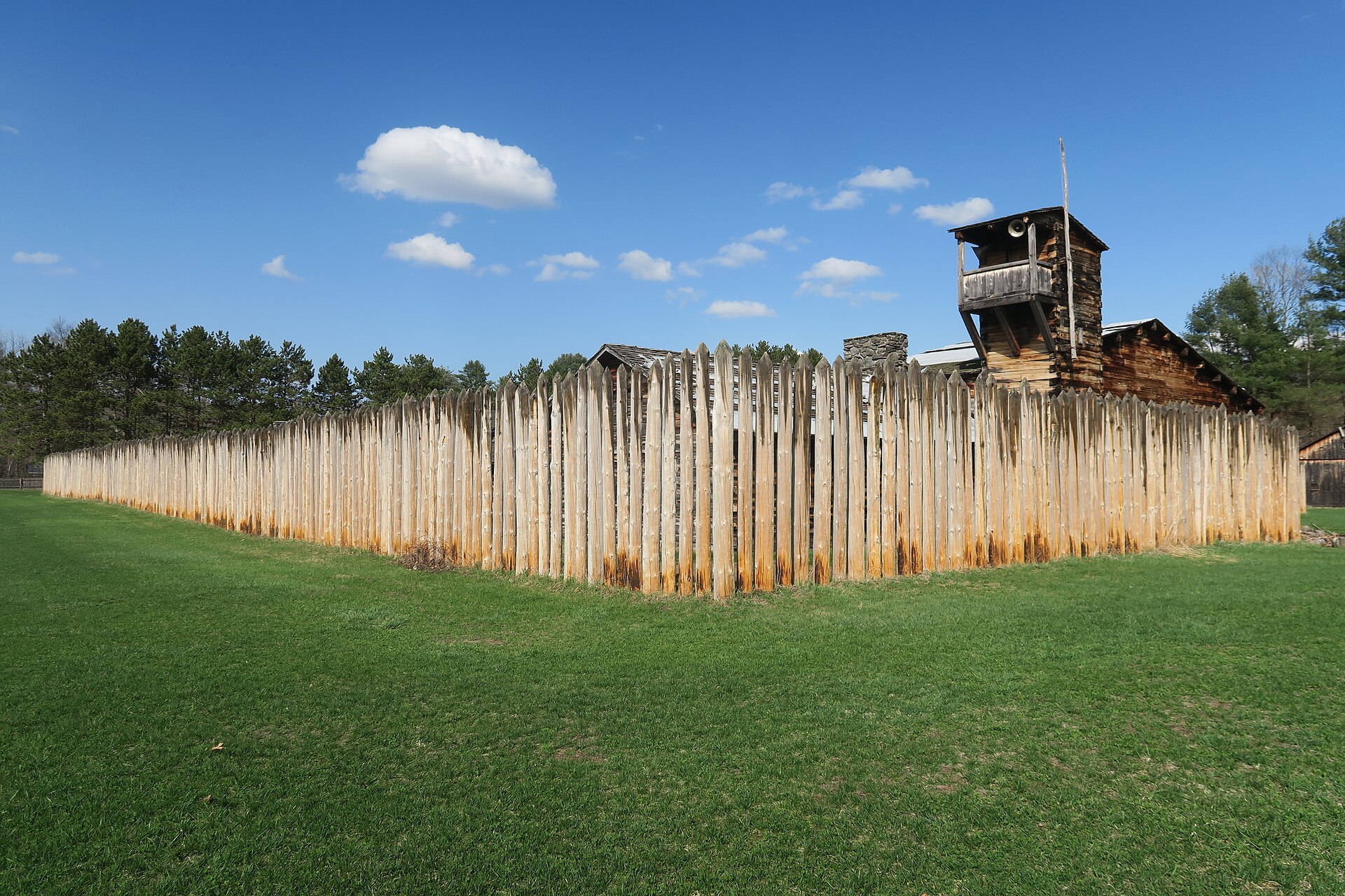
The Fort at Number 4 in Charlestown reconstructs the northernmost British settlement on the Connecticut River. The townspeople voted in 1744 to move several houses together into a fortified compound, and the stockade went on to play a significant role in the French and Indian War. Today it operates as a living-history museum with seasonal reenactments; check the schedule before travelling, as opening is seasonal.
On the coast, the Wentworth-Coolidge Mansion in Portsmouth was the residence of Benning Wentworth, New Hampshire’s first royal governor, who held office from 1741 to 1767. The rambling 40-room house grew by accretion rather than design, and admission is free with donations welcomed. A short walk away, the John Paul Jones House was built in 1758 by the master housewright Hopestill Cheswell; the Revolutionary War naval commander lodged there in 1781–82, when the building operated as a boarding house, while supervising work on the ship America. It is now a museum run by the Portsmouth Historical Society; the building’s history is set out in the John Paul Jones House record.
The wider Portsmouth historic district preserves the maritime prosperity of the 17th and 18th centuries in timber and brick, and rewards a slow walk in spring or autumn. For coastal defence of a much later vintage, Fort Stark in New Castle preserves gun batteries from the turn of the 20th century that remained in service through the Second World War; entry is free but hours vary seasonally.
Shakers, Sculptors and Presidents
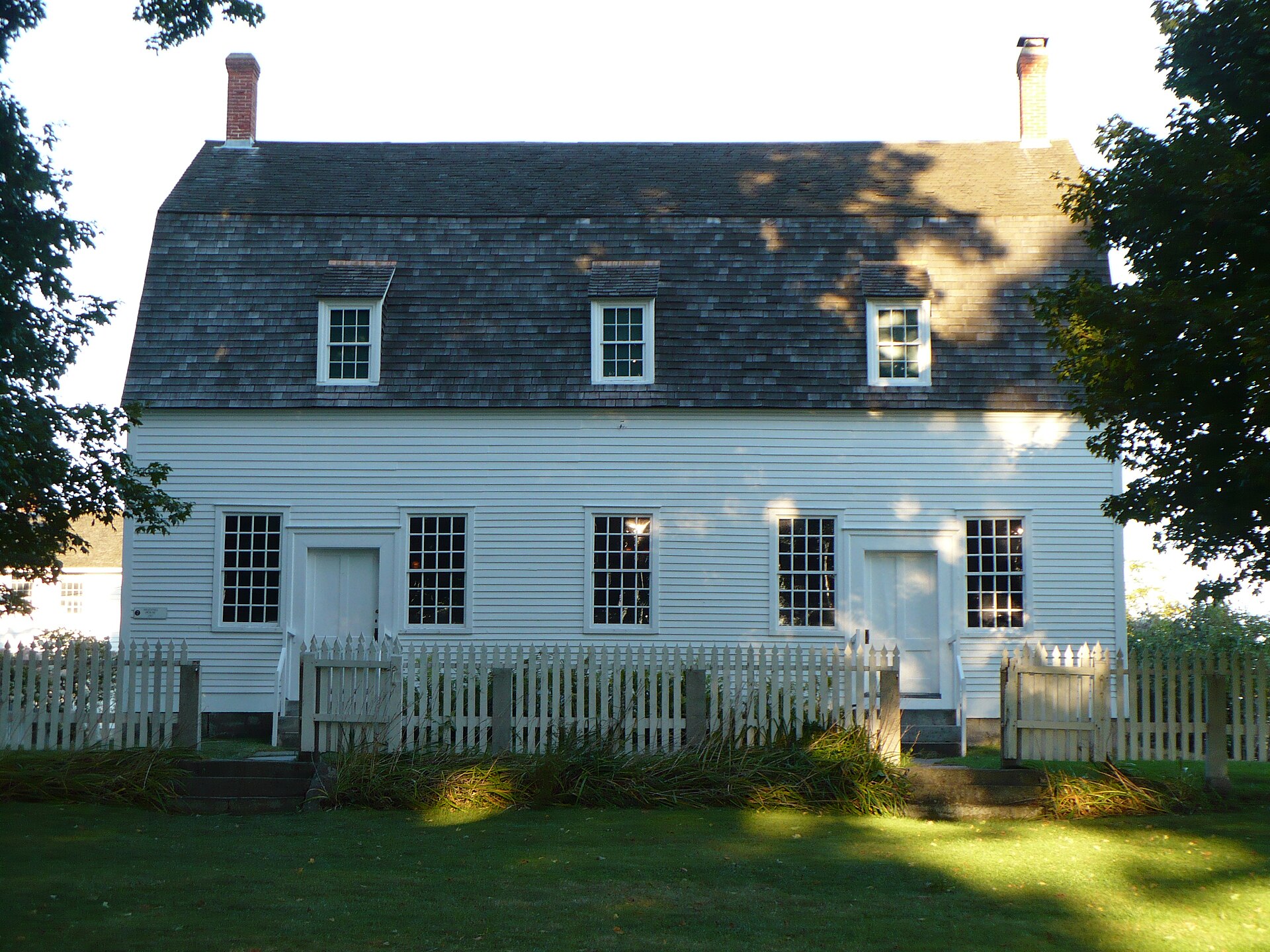
Canterbury Shaker Village was gathered in 1792 under Father Job Bishop and became one of the most successful Shaker communities in America. Twenty-seven original Shaker buildings survive alongside four reconstructions on 694 acres held under permanent conservation easement. The village functioned as a living community until Sister Ethel Hudson, the last Canterbury Shaker, died in September 1992 at the age of 96; it was declared a National Historic Landmark in 1993 and now operates solely as a museum. See the National Park Service overview for visiting context.
In Cornish, Saint-Gaudens National Historical Park preserves the home, gardens and studios of Augustus Saint-Gaudens, the sculptor whose work defined American public monuments in the late 19th and early 20th centuries. Summer is the season, when the gardens are at their fullest and guided tours run. In Derry, the Robert Frost Farm holds the plain New England farmhouse and barn where Frost lived in the first decade of the 20th century and drew the landscape that runs through his poems; summer poetry readings are the reason to time a visit. And in Hillsborough, the Franklin Pierce Homestead — Federal-style, with a second-floor ballroom — marks the boyhood home of the 14th President.
Planning a Route Through Ancient New Hampshire
The deep-past sites are mostly not visitable in the way a fort or a mansion is. Potter, Tenant Swamp and the Israel River sites are protected archaeological properties without public interpretation on the ground; the Mount Jasper shaft is on city land in Berlin but is not a developed attraction. The rewarding route is to pair what you can walk — Endicott Rock at Weirs Beach, the Fort at Number 4, Canterbury, Portsmouth — with the published archaeology that explains what lies beneath the rest of the state. New Hampshire’s Division of Historical Resources runs SCRAP, the State Conservation and Rescue Archaeology Program, which trains volunteers on active excavations and is the single best way for a non-specialist to see this material first-hand.
For comparable deep-time sites elsewhere in North America, see our features on Meadowcroft Rockshelter, Kincaid Mounds and the ancient sites of New Mexico, or browse the full Ancient Civilizations archive.
Sources and Further Reading
- Pre-Colonial North America — World History Encyclopedia, on the Paleoindian and Clovis horizon.
- Paleoindian Site Uncovered in Connecticut — Archaeology Magazine, on the 12,500-year-old Farmington River camp.
- Archaeology in New Hampshire — New Hampshire Magazine.
- Mount Jasper Lithic Source — quarry, shaft depth and National Register listing.
- America’s Stonehenge — site history and the full radiocarbon table.
- Endicott Rock and John Paul Jones House — inscription and building histories.
- Canterbury Shaker Village — US National Park Service.