The ancient sites of New Mexico are the surviving settlements, cliff dwellings, rock-art panels and mission ruins built across the state between roughly AD 850 and 1700 by Ancestral Puebloan, Mogollon and Jornada Mogollon peoples, and later by Spanish Franciscans. New Mexico holds a density of surviving pre-Columbian architecture unmatched anywhere else in the United States. Between roughly AD 850 and 1250, Ancestral Puebloan builders in the San Juan Basin raised multi-storey masonry complexes that remained the largest buildings in North America until the nineteenth century. Mogollon communities to the south carved dwellings into cliff alcoves. Jornada Mogollon carvers pecked tens of thousands of images into basalt. Then, from 1598, Spanish Franciscans layered mission churches on top of living pueblos — and at Acoma, one of those pueblos is still occupied today.
The twelve sites below span that full arc, from the astronomy-aligned great houses of Chaco Canyon to the mesa-top village the Acoma call Haak’u. Each entry covers what survives, who built it, and what a visitor should know before setting out. The statewide record is administered by the Archaeological Records Management Section of the New Mexico Department of Cultural Affairs, which maintains the largest automated cultural resources database in the country. For wider context on the cultures behind these places, see our Ancient Civilizations and Historical Places archives, and the World History Encyclopedia entry on Chaco Canyon.
Chaco Culture National Historical Park
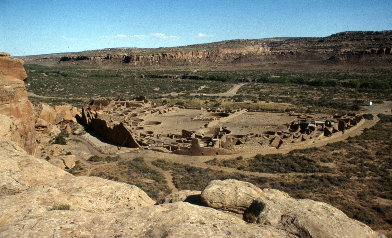
Pueblo Bonito and the great houses
Chaco Canyon was the ceremonial and administrative heart of the Puebloan world between roughly AD 850 and 1250, and it is one of only a couple of dozen UNESCO World Heritage Sites in the United States. Fifteen major complexes known as great houses stand within the canyon. The largest, Pueblo Bonito, contained close to 700 rooms and rose four to five storeys — the largest building anywhere in North America until the nineteenth century. Its sandstone was quarried and carried in from distant sources, and walls, doorways and kivas were aligned to the solstices, the equinoxes and the 18.6-year lunar standstill cycle, an accuracy that required generations of sustained observation. A network of engineered roads radiates outward from the canyon toward outlying great houses. Nearby Chetro Ketl is the second-largest complex on the canyon floor. Spring and autumn are the sensible visiting seasons; there is an entrance fee, camping requires a permit, and the final approach is on unpaved road.
Gila Cliff Dwellings National Monument
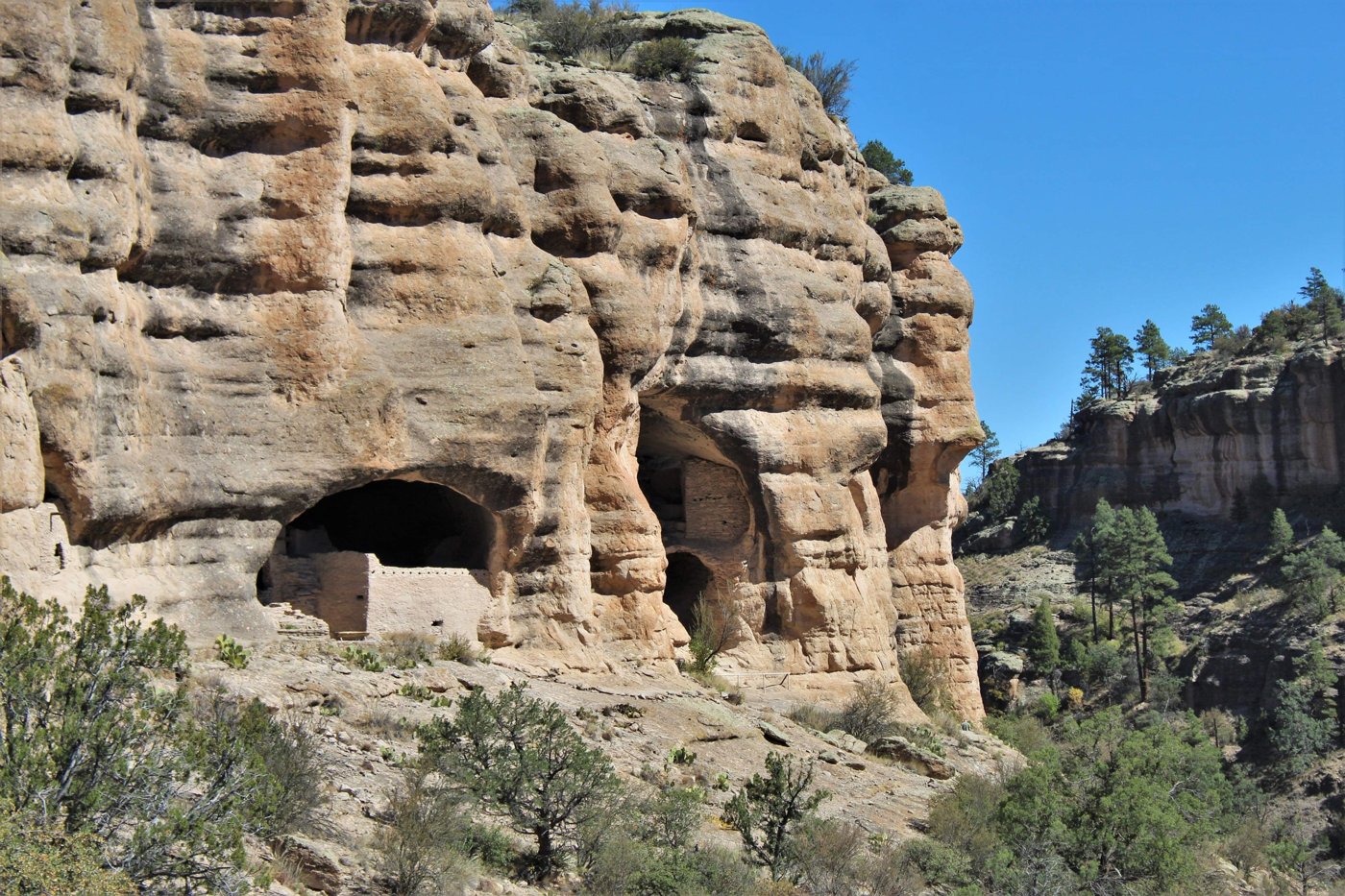
Built in the late 1200s by Mogollon people, these dwellings occupy five natural caves in a narrow side canyon above the Gila River. The interlinked rooms — 42 of them — were constructed inside the alcoves themselves rather than against an open cliff face, and the site was apparently occupied for only a generation or two before being abandoned. The one-mile loop trail climbs about 180 feet. The monument is open year round, but April to October is the comfortable window; ranger-led talks run in season. See the National Park Service monument page for current road and trail status.
Bandelier National Monument
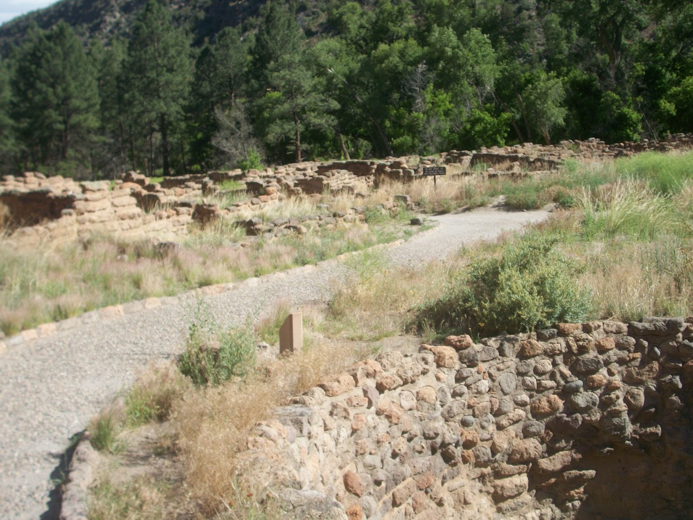
Bandelier preserves the remains of villages occupied from roughly the eleventh to the sixteenth centuries in Frijoles Canyon, on the flanks of the Jemez volcanic field. The 1.2-mile Main Loop Trail passes Tyuonyi, a large circular ground-level pueblo enclosing a central plaza, and continues past cavates — small chambers hollowed into the soft volcanic tuff — before reaching Long House. Alcove House sits 140 feet above the canyon floor and is reached by four wooden ladders. The park service operates a shuttle from White Rock during peak months. Early autumn is ideal.
Aztec Ruins National Monument
The name is a nineteenth-century misattribution: the builders were Ancestral Puebloans, not Aztecs, and the complex went up in the early 1100s as a northern outlier of the Chaco system. Its West Ruin held around 400 rooms. The site’s centrepiece is the Great Kiva, built between about 1100 and 1130, excavated by archaeologist Earl Morris in 1921 and reconstructed under his direction in 1933–34 with Public Works Administration and Carnegie Institution funding. It remains the only fully restored great kiva in the Southwest, and walking into it gives a sense of enclosed ceremonial space that no ruin wall can. Our full write-up of the site is here: Aztec Ruins National Monument. Cooler months are best; there is a modest entrance fee.
Acoma Pueblo — Sky City
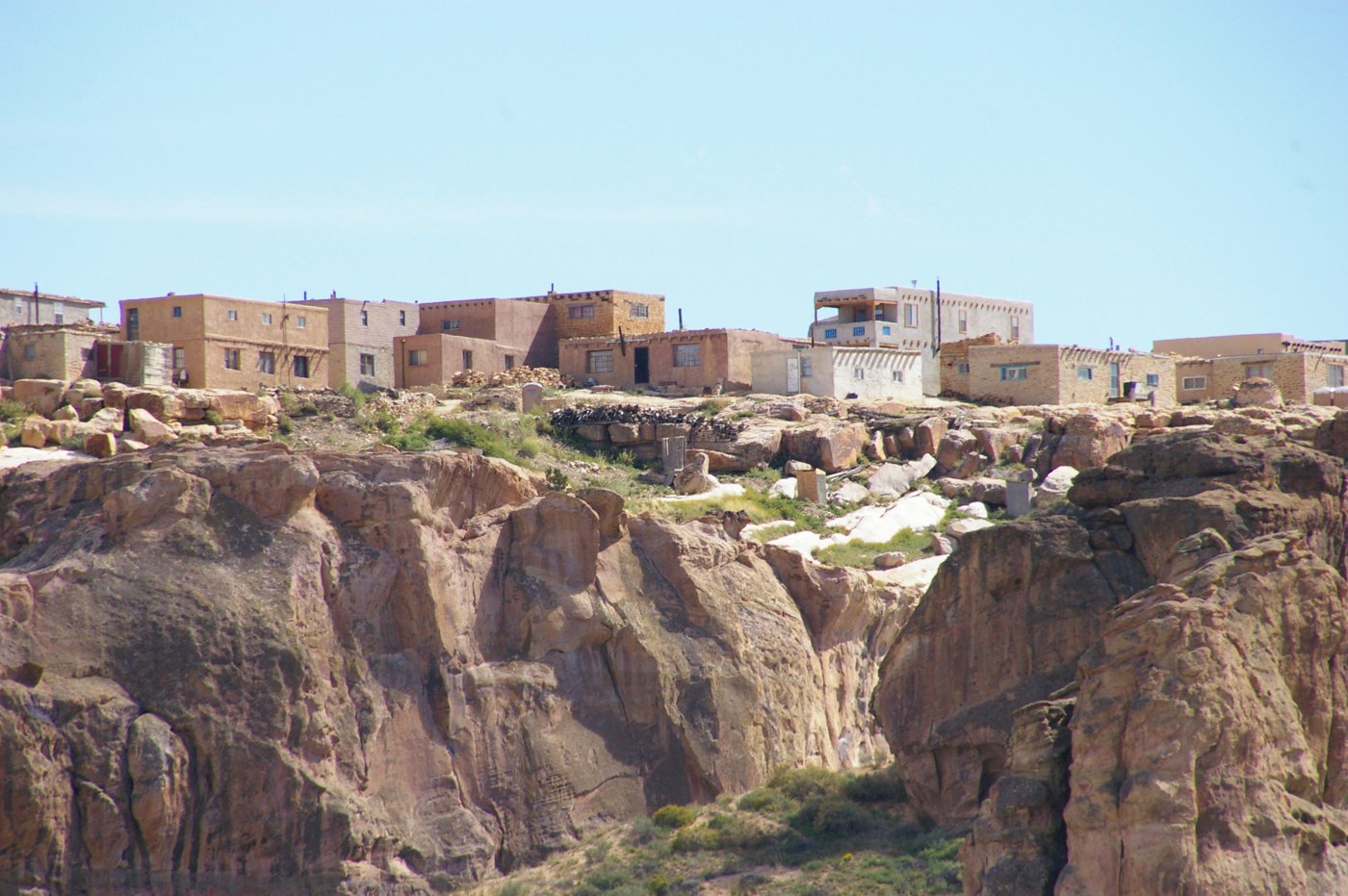
Acoma sits on a sandstone mesa roughly 360 feet above the surrounding plain, about 55 miles west-southwest of Albuquerque, and is widely regarded as the oldest continuously inhabited community in the United States. Construction of the mesa-top village dates to between about AD 1100 and 1250, and the adobe houses, plazas and walkways have been in use for close to a thousand years. The name means “people of the white rock” in the Keresan dialect. The San Esteban del Rey mission church, begun in 1629, still stands on the mesa. Acoma is a sovereign, living community, not a park: access to the mesa is by guided tour booked through the Sky City Cultural Center only, photography requires a permit, and some areas are closed to visitors entirely. Background reading: Acoma Pueblo.
Petroglyph National Monument
Along a 17-mile escarpment of basalt boulders on Albuquerque’s west edge sit an estimated 24,000 carved images, most of them made between roughly 1300 and 1600 by Ancestral Puebloan people building adobe villages along the Rio Grande, with a later layer added by Spanish settlers. It is one of the largest petroglyph concentrations in North America. Three separate trail areas — Boca Negra, Rinconada and Piedras Marcadas — give access; the monument charges no entrance fee, though Boca Negra has a parking charge. Go early or late, when raking light throws the carvings into relief.
Salinas Pueblo Missions National Monument
Abó, Quarai and Gran Quivira
The monument is three separate units — Abó, Quarai and Gran Quivira — clustered around Mountainair, about 80 miles southeast of Albuquerque, in a region the Spanish called the Salinas Province after its salt deposits. Each pairs a seventeenth-century Franciscan mission with the pueblo it was imposed on. Quarai’s Nuestra Señora de la Purísima Concepción de Cuarac preserves the greatest volume of standing mission masonry; Gran Quivira, the largest unit at roughly 611 acres, was a city of multiple pueblos whose first church was begun in 1629. All three were abandoned by the 1670s under drought, raiding and disease. Admission is free at all units; see the official monument page and Archaeology Southwest for background and hours.
Three Rivers Petroglyph Site
Managed by the Bureau of Land Management in the Tularosa Basin, Three Rivers holds more than 21,000 petroglyphs strung along a basalt ridge — human figures, masks, birds, fish, geometric designs. They were made by Jornada Mogollon people between roughly AD 900 and 1400, which makes this one of the few sites where a single cultural tradition’s imagery can be followed at scale. A rough one-mile trail runs the ridge. There is a small day-use fee, and morning or late-afternoon light is essential.
Pecos National Historical Park
Pecos Pueblo occupied a strategic gap between the Rio Grande pueblos and the Plains, and at its height in the fifteenth century it was a five-storey complex of some 2,000 people controlling trade between the two worlds. The Franciscan mission church that followed was burned in the Pueblo Revolt of 1680 and rebuilt in 1717; its adobe ruins still dominate the mesilla. The pueblo’s last 17 residents left on 2 August 1838 and walked roughly 80 miles northwest to Jemez, the only other community still speaking their Towa language. We cover it in detail in Pecos National Historical Park. The park is open year round; April to October is easiest.
El Morro National Monument
El Morro is a sandstone headland with a reliable pool at its base — the reason it became a stopping point for Ancestral Puebloans, Spanish expeditions and American surveyors in turn. More than 2,000 inscriptions, signatures and petroglyphs are cut into the rock, the earliest Spanish one left by Juan de Oñate in 1605. Atop the headland sit the ruins of Atsinna, a 355-room pueblo occupied in the thirteenth century. The half-mile Inscription Rock trail is easy; the two-mile Headland trail is not. Entry to the monument is free.
Puyé Cliff Dwellings
On Santa Clara Pueblo land west of Española, Puyé preserves a mesa-top village and two tiers of cliff dwellings cut into a 200-foot ridge of volcanic tuff — some 740 rooms in all, housing as many as 1,500 people. Occupation ran from roughly 1250 until about 1580, when drought pushed its people down to the Rio Grande and they founded Santa Clara. It was designated a National Historic Landmark in 1966 and is owned and interpreted by the descendant community — tours are led by Santa Clara guides. Our full account: Puyé Cliff Dwellings.
Fort Union National Monument
The only entry here that is not pre-Columbian, Fort Union was established in 1851 where the Mountain and Cimarron branches of the Santa Fe Trail rejoin, and grew into the largest nineteenth-century military post in the Southwest and the supply depot for the whole region. What survives is an extensive field of adobe walls and chimneys, plus visible wagon ruts from the trail itself. Entry to the monument is free; summer is the practical season, though it is exposed and hot.
Which New Mexico ancient site should you visit first?
If you have one day and want the single most significant site, go to Chaco — but budget for the drive, because the last stretch is unpaved washboard and can be impassable after rain. If you have one day and limited appetite for backcountry driving, Bandelier gives you cliff dwellings, a ground-level pueblo and a ladder climb inside a 1.2-mile loop, an hour from Santa Fe. If what you want is a living culture rather than a ruin, book an Acoma tour. For a two-day loop from Albuquerque, pair Petroglyph and Salinas on the first day and Bandelier and Pecos on the second.
How were these sites dated, and how reliable are the dates?
Southwestern archaeology has an unusually strong dating tool: tree-ring dating, developed by astronomer A.E. Douglass at the University of Arizona’s Laboratory of Tree-Ring Research in the 1920s and first tested at Chaco and Aztec Ruins. Because the region’s dry climate preserves construction beams, and because ring-width patterns can be matched against a master chronology stretching back more than two millennia, many Southwestern buildings can be dated to the exact year a beam was felled. That is why dates in this article are given with more confidence than is usual for pre-literate sites. Where ranges appear — “roughly 900 to 1400” for the Three Rivers carvings, for instance — it is because rock art itself carries no datable organic material and must be dated by style and by association with nearby dated settlements.
Visiting responsibly
What not to touch
Nearly all of these places are sacred to descendant communities who are still here. Do not touch or chalk petroglyphs; skin oils and pigments accelerate spalling. Do not remove sherds — even moving one destroys its context. Stay on marked trails and out of unstabilised rooms. On tribal land, follow the community’s rules on photography and restricted areas without negotiation. Federal law protects archaeological resources on public land, and collecting artefacts is a criminal offence.
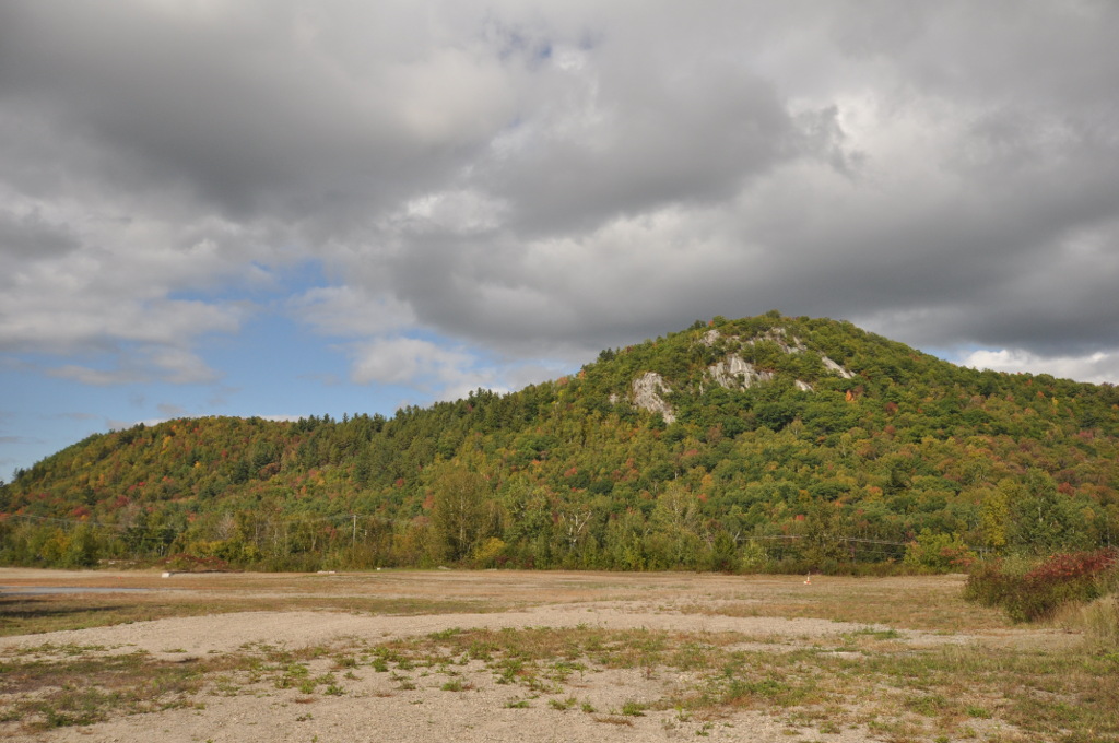
For the same depth of occupation on the other side of the continent, see our guide to the ancient sites of New Hampshire, from caribou-hunting camps to a rhyolite mine worked 9,000 years ago.