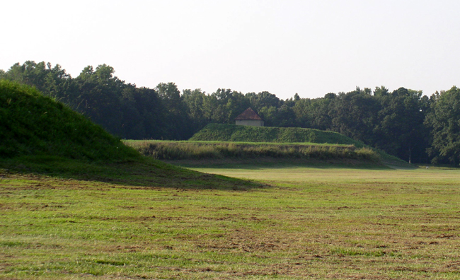
Moundville is a Mississippian culture archaeological site on the Black Warrior River in Hale County, Alabama, and one of the most important pre-Columbian settlements in North America. Built and occupied between roughly AD 1000 and 1450, it grew into a fortified political and ceremonial capital that was second in size and complexity only to Cahokia in Illinois. At its height the town held 29 flat-topped earthen mounds, a vast central plaza, and a population of one to three thousand people living behind a wooden palisade nearly a mile long.
A Mississippian Capital on the Black Warrior
The people who built Moundville belonged to the Mississippian culture, a network of maize-farming, mound-building societies that spread across the American Southeast and Midwest after about AD 1000. Archaeologists describe Moundville as the seat of a regionally organised chiefdom — a ranked society known from later Spanish accounts as the Province of Pafalaya — that controlled a stretch of the fertile Black Warrior River valley. Like the much larger city of Cahokia in Illinois, it combined a dense town, a governing elite, and a religious centre in a single planned settlement.
Occupation unfolded in phases. An early village took shape around AD 1120, and over the following century the community reorganised itself around a formal plaza ringed by mounds. After about AD 1300 the resident population began to shrink even as the site remained a sacred and ceremonial focus — a shift from crowded capital to revered necropolis that mirrors the trajectory of other Mississippian centres such as the Etowah Indian Mounds in Georgia.
Clarence Bloomfield Moore and the 1905 Excavations
Moundville’s earthworks were known to settlers in the nineteenth century, but the site entered scientific literature through Clarence Bloomfield Moore, an archaeologist with the Academy of Natural Sciences of Philadelphia who conducted the first major excavations in 1905 and 1906. Moore’s trenches into the mounds and cemeteries recovered the engraved artefacts that made Moundville famous, though by modern standards his methods prized objects over context. From the 1930s the University of Alabama took over long-term research, and the painstaking mapping of thousands of burials and house sites since then has produced the detailed chronology used today.
Twenty-Nine Mounds Around a Single Plaza
The preserved park covers 326 acres on a bluff above the river, where 29 flat-topped platform mounds are arranged with deliberate symmetry around a rectangular central plaza. The mounds were not tombs but elevated stages: each supported civic buildings, temples, or the houses of nobles, raising the elite literally and symbolically above ordinary life. They were built basket-load by basket-load from earth carried from borrow pits nearby, a feat that demanded an organised labour force and a chief able to command it.
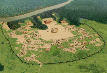
Mound A sits at the centre of the plaza, while Mound B — the largest at the site — rises about 58 feet (18 m) directly to the north, climbed by two earthen access ramps and once topped by the residence of the paramount chief. Excavations also revealed that the town was enclosed on its landward sides by a bastioned wooden palisade roughly a mile in length, rebuilt several times. That defensive wall is a reminder that, for all its ceremony, Moundville was a place that expected conflict.

How Did Moundville’s People Live and Rule?
At its peak Moundville housed roughly 1,000 to 3,000 people inside the palisade, with perhaps ten thousand more spread through farmsteads across the surrounding valley. Society was sharply ranked: a small noble class lived atop the mounds and was buried with copper, marine shell, and finely engraved stone, while commoners occupied smaller dwellings and simpler graves. The exotic raw materials — copper from the Great Lakes, shell from the Gulf — show that Moundville’s chiefs plugged into long-distance exchange networks that linked Mississippian centres from the Ocmulgee mounds in Georgia to the Mississippi Valley.
The chiefdom’s authority rested on a blend of control over food surplus, descent from prestigious ancestors, and command of ritual. The same ideology is visible at related sites such as the elite “Birdman” burial at Cahokia, where status and sacred symbolism were buried together. Moundville’s nobles advertised that power in the objects they left behind — and in one artefact above all.
The Rattlesnake Disk and the Path of Souls
The single most famous object from Moundville is the Rattlesnake Disk, a perfectly circular sandstone palette about twelve inches across, recorded by Moore in 1905 and now displayed at the site’s Jones Archaeological Museum. Its engraved face shows two knotted, horned rattlesnakes whose bodies frame a central hand with an open eye set in the palm. The disk is a masterpiece of Mississippian art and the emblem most associated with the site.
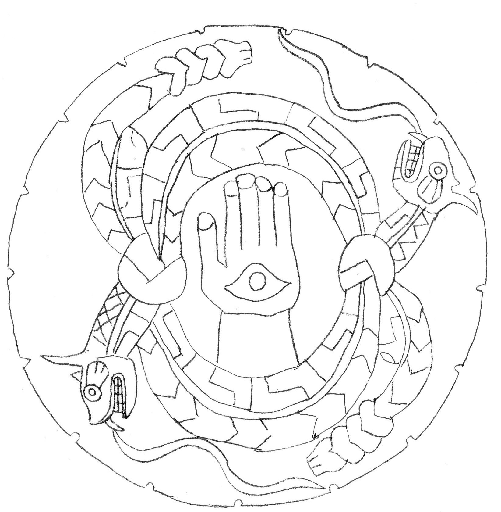
To archaeologists the hand-and-eye is not decoration but cosmology. Many researchers read it as a portal on the “Path of Souls” — the route the dead were believed to travel along the Milky Way — with the hand representing a star constellation that marked the doorway to the afterlife. The serpents, guardians of the spirit world, coil around that opening. Read this way, the disk is a map of the journey after death rendered in stone.
The Southeastern Ceremonial Complex
Moundville’s imagery belongs to the Southeastern Ceremonial Complex (often called the Southern Cult), a shared set of religious symbols — winged serpents, hands and eyes, raptors, and weeping eyes — that appears on prestige goods across the Mississippian world. The complex was not a single church but a web of belief and exchange that gave distant elites a common visual language. Moundville was one of its great workshops, producing engraved palettes and pottery whose motifs turn up at sites hundreds of miles away.
Why Was Moundville Abandoned?
Moundville’s decline was gradual rather than catastrophic. After about AD 1350 the resident population thinned, the town’s role narrowed toward ceremony and burial, and by the 1500s most of the site stood largely empty. Archaeologists have proposed several overlapping causes: soil exhaustion and shifting river channels straining local farming, the political fragility of chiefdoms that rose and fell with individual leaders, and the realignment of trade and alliance across the region. No single disaster explains it.
What came after is clearer in outline than in detail. The descendants of the Mississippian peoples of the central Southeast are counted among the historic nations of the region, and the regional successor of Moundville’s tradition can be seen in later mound centres such as Emerald Mound in Mississippi, capital of the Natchez. By the time Europeans recorded the area, the great town on the Black Warrior was already a memory among the living communities around it.
Visiting Moundville Archaeological Park Today
Today the site is preserved as Moundville Archaeological Park, operated by the University of Alabama Museums and recognised as a National Historic Landmark. Visitors can walk among the mounds, climb Mound B, and see the Rattlesnake Disk and other engraved treasures in the on-site Jones Archaeological Museum. For readers exploring the wider story of North America’s earthworks, Moundville sits alongside other major centres documented in our guide to historical places, from Cahokia to the river valleys of the Southeast.
Sources and Further Reading
- Wikipedia — Moundville Archaeological Site
- Encyclopedia of Alabama — Moundville Archaeological Park
- University of Alabama Museums — About Moundville
- World History Encyclopedia — Cahokia (Mississippian comparison)
- World History Encyclopedia — Map of Mississippian and Related Cultures
- Wikipedia — Southeastern Ceremonial Complex

Neural Pathways is a collective of seasoned experts and researchers with a profound passion for unraveling the enigmas of ancient history and artifacts. With a wealth of combined experience spanning decades, Neural Pathways has established itself as a leading voice in the realm of archaeological exploration and interpretation.