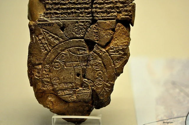
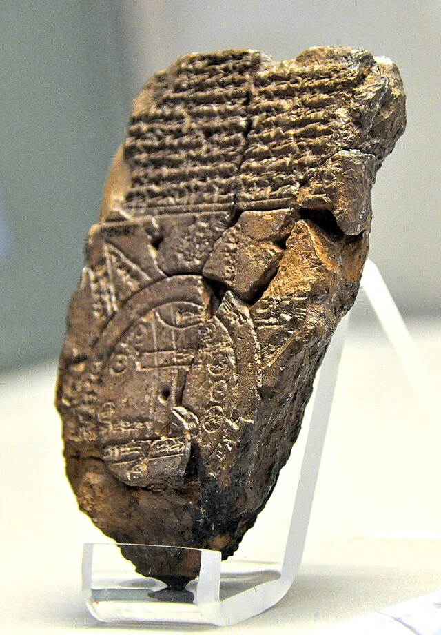
The Babylonian Map of the World, known as the Imago Mundi, represents one of the earliest attempts to depict the known world. This ancient artifact provides insights into how the Babylonians viewed geography and their place within it. The map dates to the 6th century BC and originates from Sippar, Iraq. It is currently housed in the British Museum.
Get your dose of History via Email
Physical Description
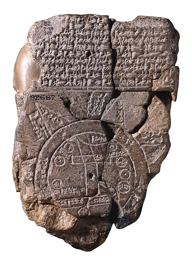
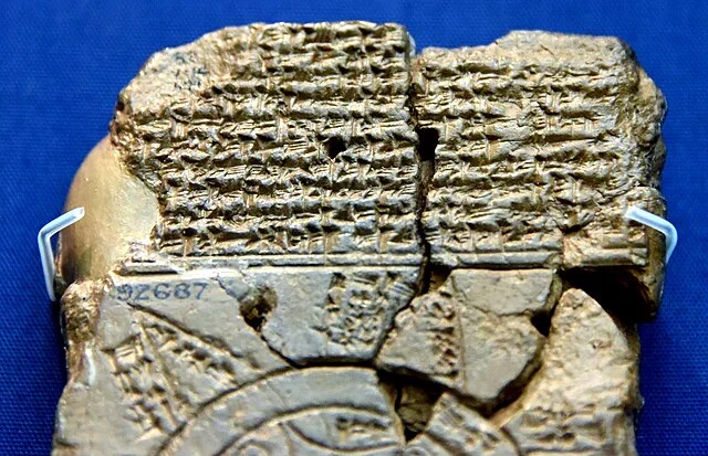
The Imago Mundi is a clay tablet measuring approximately 12 centimeters by 9 centimeters. Scholars believe that it was created in the Neo-Babylonian period. The surface of the tablet features a detailed map along with cuneiform inscriptions that provide descriptions of various regions and landmarks.
Geographic Representation
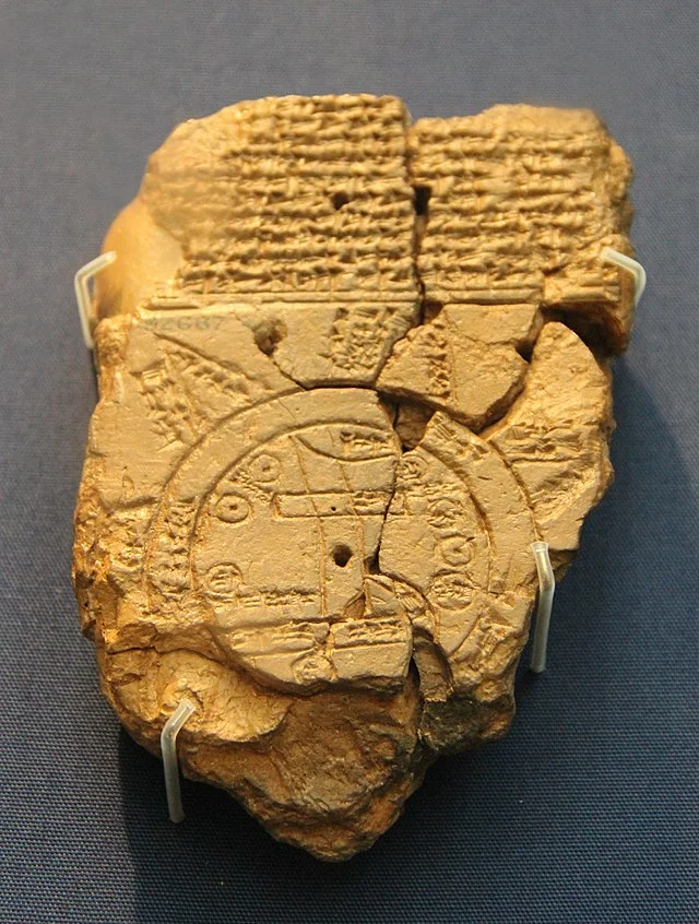
The map displays a simplified view of the world as understood by the Babylonians. It includes Babylon at the center, surrounded by a series of regions. These regions include Assyria, the Mediterranean, and even parts of Arabia. The representation is not to scale, but it emphasizes significant locations, demonstrating their importance to Babylonian society.
Features of the Map
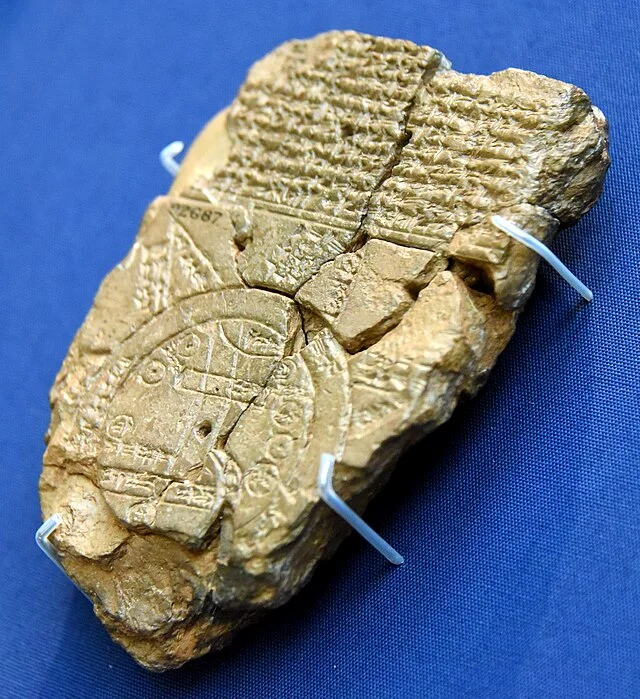
The Babylonian Map of the World highlights several notable features. It includes the Tigris and Euphrates rivers, which were crucial to Babylonian agriculture and culture. It also depicts various territories, including the land of the Hittites and the area of the “four quarters” of the world.
Symbolic Elements
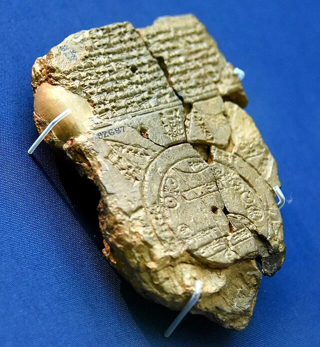
The map contains symbolic elements that reflect the Babylonian worldview. For instance, the circular shape of the world suggests a limited understanding of geography. Additionally, the map illustrates mythical elements, such as a reference to the “sweet waters” at the world’s edge. This reflects the belief in a boundary beyond which lay the unknown.
Historical Context
The creation of the Imago Mundi occurred during a time of significant cultural and intellectual development in Babylon. The Neo-Babylonian Empire, particularly under King Nebuchadnezzar II, saw advancements in various fields, including astronomy, mathematics, and geography. The map symbolizes the intersection of these disciplines, serving both practical and educational purposes.
Importance and Legacy
The Babylonian Map of the World holds great historical significance. It provides a window into ancient Babylonian civilization and its understanding of geography. Furthermore, it influences later cartographic traditions in the ancient Near East. Scholars recognize this map as one of the earliest known representations of the world, highlighting the Babylonians’ contributions to geography.
Conclusion
The Babylonian Map of the World is a remarkable artifact that offers valuable insights into the ancient Babylonian worldview. It reflects the geographical knowledge of its time and emphasizes the cultural significance of geography in Babylonian society. By studying this map, historians and archaeologists gain a better understanding of the early foundations of cartography and the development of geographic thought.
Source:
Neural Pathways is a collective of seasoned experts and researchers with a profound passion for unraveling the enigmas of ancient history and artifacts. With a wealth of combined experience spanning decades, Neural Pathways has established itself as a leading voice in the realm of archaeological exploration and interpretation.