The ancient sites in Poland are usually introduced through Wawel Hill and Malbork, which is to say through the medieval period. That framing skips roughly four thousand years. The country’s deepest archaeological layers sit in two very different landscapes: a limestone ridge in the Świętokrzyskie region where Neolithic miners sank more than 4,000 shafts after about 3900 BC, and a marshy lake peninsula in Kuyavia where a Lusatian community felled a stand of oak in the winter of 748/747 BC and built a fortified town on the timber. Between those prehistoric anchors and the brick fortresses of the fourteenth century lies one of the more legible archaeological sequences in central Europe, much of it now protected among Poland’s seventeen UNESCO World Heritage properties. For comparable sites elsewhere, see our Ancient Civilizations and Historical Places archives.

How Old Are the Oldest Ancient Sites in Poland?
The oldest monumental site in the country is industrial rather than ceremonial. Flint extraction at Krzemionki began around 3900 BC, which places it well over a thousand years before the earliest earthwork phase at Stonehenge and some 5,200 years before the cathedral on Wawel Hill was consecrated. Biskupin, the site most Poles would name as the country’s prehistoric emblem, is comparatively late: its oak was cut in the 740s BC, roughly contemporary with the traditional foundation date of Rome.
Between the two sits a scatter of Neolithic funerary architecture, including the earthen long barrows of Wietrzychowice in Kuyavia, and the early medieval island strongholds of the Piast dynasty, of which Ostrów Lednicki is the best excavated. The pattern worth holding in mind is that Poland’s prehistory survives chiefly in wood, earth and stone quarried underground, while its historical monuments are overwhelmingly brick.
Krzemionki: 4,000 Shafts Across 78.5 Hectares
Krzemionki, or Krzemionki Opatowskie, lies about eight kilometres north-east of Ostrowiec Świętokrzyski. What the miners were after was banded flint, a striped Upper Jurassic (Oxfordian) stone that occurs in workable seams almost nowhere else, and which was valued enough to be shaped into axeheads and chisels and carried extraordinary distances. Tools of Krzemionki flint have been recorded as far as 660 kilometres from the mines. The Funnelbeaker culture opened the workings and distributed products up to about 300 kilometres; the Globular Amphora culture exploited them more intensively and pushed that radius to roughly 500 kilometres; the Mierzanowice culture worked the final phase before extraction declined between about 1800 and 1600 BC.
Shafts, Adits and Engravings
The scale is easier to grasp in numbers. The mining belt runs 4.5 kilometres long and between 25 and 180 metres wide, covering 78.5 hectares. More than 4,000 shafts are known, reaching depths of around nine metres, with access openings four to twelve metres across. Short horizontal passages called adits link some of the shafts for access and drainage; they stand 55 to 120 centimetres high, and a handful carry rare engraved Neolithic drawings on their walls. Only Grime’s Graves in England and Spiennes in Belgium are genuinely comparable.
Rediscovery and Protection, 1922–2019
The geologist Jan Samsonowicz identified the mines in 1922, and Stefan Krukowski began archaeological work in 1923; Tadeusz Żurowski led the major post-war campaigns, particularly between 1958 and 1961. Krzemionki became an archaeological reserve in 1967, a Polish Historic Monument on 16 October 1994, and a UNESCO World Heritage Site on 6 July 2019. The underground tourist route, opened on 11 June 1985, runs 465 metres and descends to 11.5 metres at its deepest point.
Biskupin: The 748 BC Oak Fort Called the Polish Pompeii
Biskupin sits on what is now a peninsula in Lake Biskupin, about 90 kilometres north-east of Poznań and eight kilometres south of Żnin. In 1933 a local schoolteacher, Walenty Szwajcer, noticed wooden stakes and potsherds exposed by a drop in the lake level and reported them. Excavation began in 1934 under Józef Kostrzewski (1885–1969) and Zdzisław Rajewski (1907–1974) of Poznań University, with the first report published in 1936; about 2,500 square metres had been opened by the beginning of 1939.
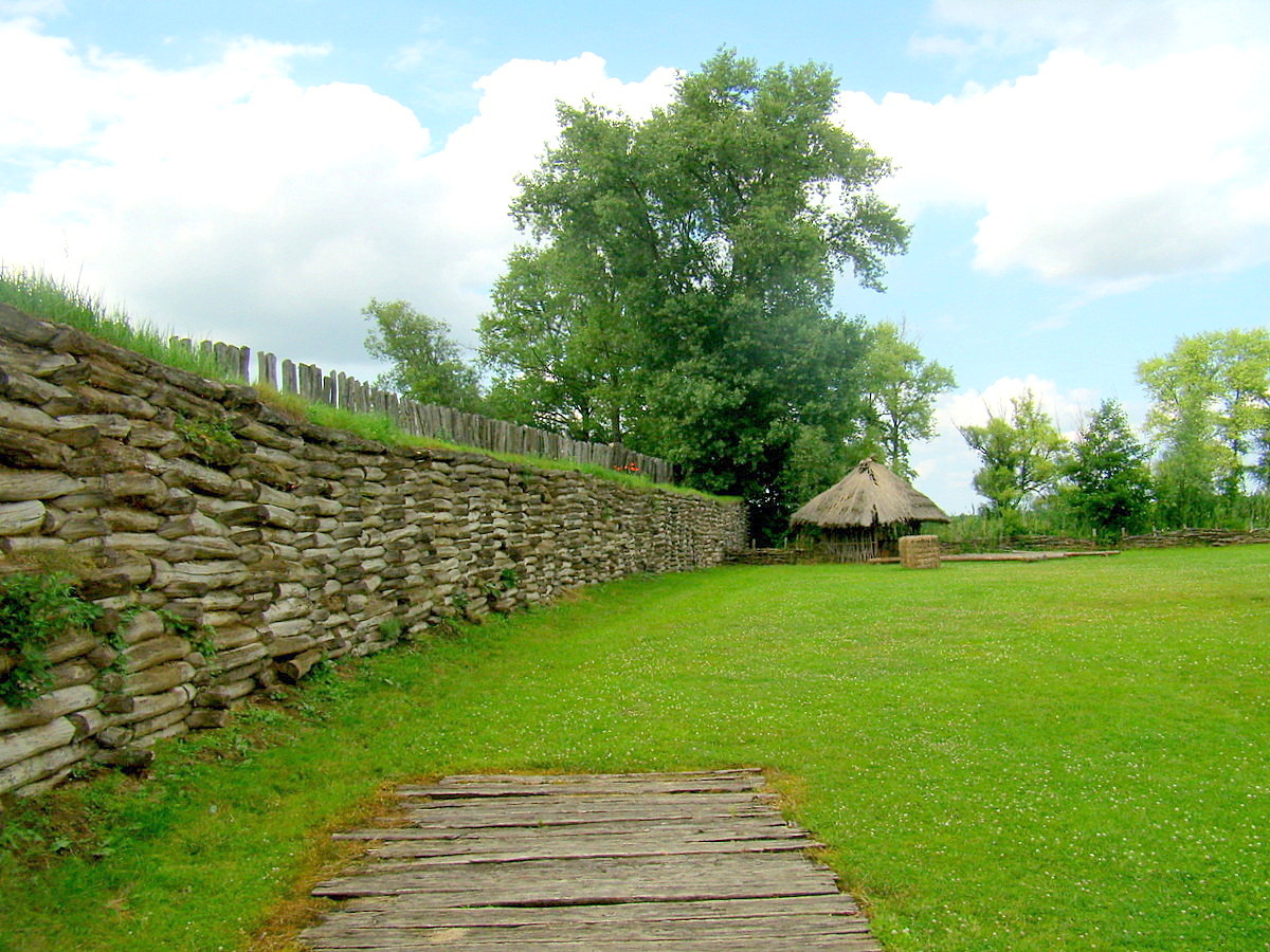
The settlement was built on an island of just over two hectares and laid out on a rectangular grid of eleven streets, each three metres wide and planked over because of the boggy ground. It held somewhere between 102 and 106 log houses of oak and pine, each about eight by ten metres, divided into two chambers with an open entrance area and a central hearth, and sized for ten to twelve occupants. Notably, no house is larger than the others, which archaeologists read as an absence of marked social stratification. A rampart of earth-filled oak boxes ran more than 450 metres around the whole, consuming an estimated 6,000 to 8,000 cubic metres of timber, with a wooden breakwater in the lake beyond it.
Radiocarbon gave broad dates; dendrochronology gave the sharp one. The oak was felled between 747 and 722 BC, with more than half of it cut in the winter of 748/747 BC — a single season’s forestry, still readable in the growth rings. The site belongs to the Lusatian culture in the Hallstatt C and D periods, not to early Slavs as first supposed, though that initial misreading is why interwar Poland embraced Biskupin as the “Polish Pompeii” and a symbol of deep national antiquity.
Urstädt: The Site Under German Occupation
Its wartime history is grim and, in one respect, accidental. Under German occupation the site was renamed Urstädt and excavated by the SS-Ahnenerbe from 1940 to 1942. Retreating German forces flooded it in an attempt at destruction; the waterlogging instead preserved the ancient timbers unusually well. Polish excavation resumed after the war and continued until 1974. Biskupin was designated a Historic Monument in September 1994 and received a European Heritage Award in 2006.
Malbork Castle: 21 Hectares of Teutonic Brick
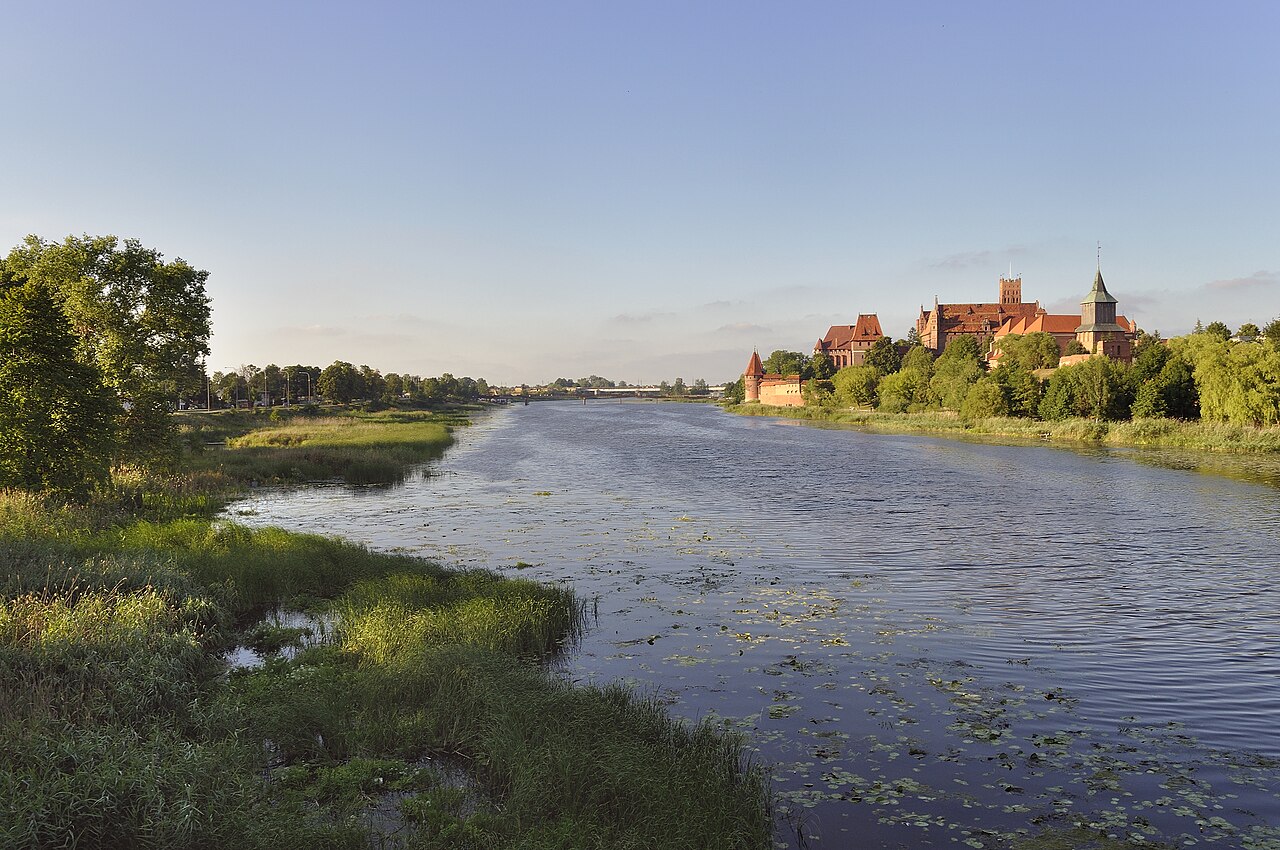
Malbork is the largest castle in the world by land area, covering about 21 hectares. Construction began in the thirteenth century and continued through the fourteenth, when it became the headquarters of the Teutonic Order. Calling it a castle understates it: the site comprises three linked castles, a palace, a monastery and hundreds of subsidiary buildings, executed almost entirely in brick, with layered defence systems that repay slow walking rather than a quick circuit of the great halls. UNESCO inscribed it in 1997. The order’s long confrontation with the Polish crown eventually produced the cavalry tradition behind the Polish winged hussar’s armour.
Practical note: the grounds are extensive and largely unshaded, so the cooler months are more comfortable for a full visit. Entrance is ticketed, with concessions for students and seniors.
Wieliczka and Bochnia: Nine Levels, 300 Kilometres of Galleries
The rock salt deposit at Wieliczka and Bochnia, south-east of Kraków, has been mined since the thirteenth century. The workings spread across nine levels and some 300 kilometres of galleries, and the miners carved altars, statues and entire chapels out of the salt itself — the Chapel of St Kinga is the one visitors are taken to, and the one that justifies the underground cathedral comparisons. Wieliczka appeared on the first UNESCO World Heritage List in 1978. The mine holds a steady cool temperature year round, which makes it a rewarding summer visit; tickets are best bought in advance.
Kraków, Warsaw and Zamość: The Urban Heritage Layer
Wawel Hill in Kraków is the densest historical site in the country, royal residence and coronation church together; Wawel Cathedral was consecrated in 1364. The Historic Centre of Kraków, including the Main Market Square and the Renaissance Cloth Hall with the Sukiennice Museum above its arcade, was itself inscribed in 1978, alongside the fourteenth-century Kazimierz district.
Warsaw’s Old Town, established in the thirteenth century, was almost entirely destroyed in the Second World War and then meticulously rebuilt — the reconstruction, rather than surviving original fabric, is what UNESCO recognised when it inscribed the historic centre in 1980. The Royal Castle followed the same trajectory: fourteenth-century origins, wartime destruction, post-war rebuilding, and a return to service as the symbolic seat of Polish sovereignty. The Warsaw Barbican, first built in 1540, survives as a fragment of the ring of fortifications that once enclosed the town.
Zamość in the south-east is the outlier: a late sixteenth-century new town laid out in a single campaign according to Italian theories of the ideal city, and preserved coherently enough to be inscribed by UNESCO in 1992. The Great Market Square and the cathedral are the set pieces, but the point of Zamość is the plan itself.
Wrocław, Białowieża and Auschwitz-Birkenau
Wrocław’s Ostrów Tumski, once an island, carries a cathedral whose origins reach back to the tenth century. On the other side of the city’s history stands Centennial Hall, built in 1913, a landmark of early modernism whose pioneering reinforced-concrete dome earned it World Heritage status in 2006; it still functions as an events venue, and visiting during a performance is the better way to see the interior.
Białowieża Forest, on the Belarusian border, preserves the last substantial remnant of the primeval lowland forest that once covered much of the European plain, and with it the European bison. It was inscribed in 1979. Spring and autumn are the productive seasons for wildlife; the forest itself is free to enter, while the strict reserve and guided routes are charged.
Auschwitz-Birkenau, established in 1940 and liberated in 1945, is a World Heritage site of a different order — a preserved place of atrocity rather than a monument, inscribed in 1979. Entry to the memorial is free, guided tours are charged, and booking well ahead is effectively required. It asks to be visited with the seriousness it records.
At a Glance
- Country: Poland
- Date range: c. 3900 BC (first flint extraction at Krzemionki) to 1945 (liberation of Auschwitz-Birkenau)
- Oldest site: Krzemionki striped flint mines — more than 4,000 shafts across 78.5 hectares, worked c. 3900–1600 BC
- Cultures represented: Funnelbeaker, Globular Amphora, Mierzanowice, Lusatian, Piast dynasty, Teutonic Order, Polish–Lithuanian Commonwealth
- Largest monument: Malbork Castle — c. 21 hectares, the largest castle in the world by land area, inscribed 1997
- UNESCO World Heritage properties: 17 in total; the earliest inscribed in 1978 (Historic Centre of Kraków; Wieliczka and Bochnia Royal Salt Mines), the most recent prehistoric addition Krzemionki in 2019
Sources and Further Reading
- UNESCO World Heritage Centre — Krzemionki Prehistoric Striped Flint Mining Region
- UNESCO World Heritage Centre — Castle of the Teutonic Order in Malbork
- UNESCO World Heritage Centre — Wieliczka and Bochnia Royal Salt Mines
- Krzemionki — mine dimensions, shaft counts and excavation history
- Biskupin — dendrochronology, house counts and rampart construction
- Culture.pl — Biskupin: The Polish Pompeii