The ancient sites of North Macedonia are a near-continuous archaeological record stretching from the Neolithic to the late Middle Ages, compressed into a country smaller than Vermont. The sequence begins on the Skopje plain around 6000 BC at the tell of Tumba Mažari, runs through the Paeonian and Macedonian towns of Bylazora and Stobi, absorbs a Roman legionary colony at Scupi, and closes with the fortresses of Ohrid and Prilep. This guide covers nine of the most significant of them, with the dates, discovery histories and access details that actually matter on the ground.
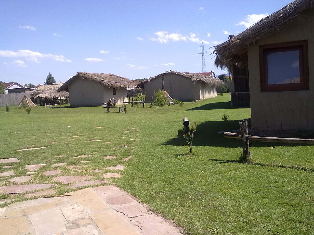
Tumba Madžari: Skopje’s Neolithic Tell, 6000–4300 BC
Tumba Madžari sits in the north-eastern suburbs of Skopje and is the most important Neolithic settlement in the Skopje valley. It was found by accident in 1961–62, during trial excavations ahead of motorway construction, and the first systematic dig followed in 1978 under Voislav Sanev of the Museum of Macedonia. The stratigraphy shows a cultural layer representing continuous occupation between roughly 6000 and 4300 BC, placing the settlement within the Anzabegovo-Vršnik cultural group.
The site is best known for its terracotta “Great Mother” house-models — cylindrical cult vessels topped with a female head, interpreted as evidence of a mother-goddess cult. One of the first structures excavated appears to have been a sanctuary rather than an ordinary dwelling. Archaeological work resumed in July 2024 after a ten-year gap, producing another Great Mother figurine, and the site team has announced its intention to prepare a UNESCO World Heritage nomination dossier.
Practical note: the site is an open-air archaeological park with reconstructed Neolithic houses, roughly 20 minutes from central Skopje. It is the single best place in the country to see what preceded the Bronze Age.
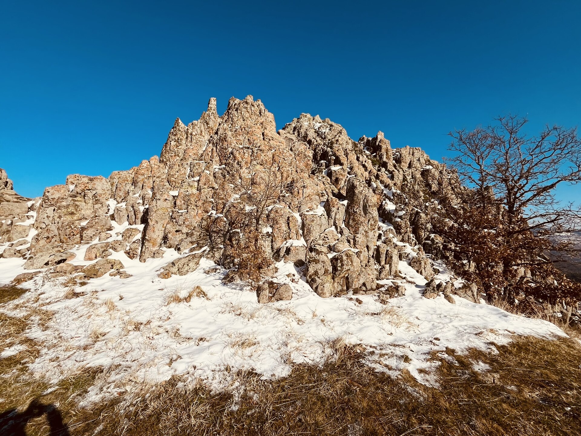
What Do the Stones at Kokino Actually Prove?
Kokino lies about 30 km from Kumanovo and 6 km from the Serbian border, on the Tatićev Kamen summit between 1,010 and 1,030 m above sea level. Archaeologist Jovica Stankovski, director of the national museum in Kumanovo, identified the site in 2001. The core outcrop covers about 90 by 50 metres; the wider archaeological zone runs to roughly 30 hectares. The oldest finds date to about the 19th century BC — the early European Bronze Age — with occupation traces continuing to the 7th century BC and the densest material from the Middle Bronze Age, c. 16th–14th centuries BC.
What Kokino unambiguously was is a mountain sanctuary. Vessels filled with offerings were found deposited in cracks in the rock, and four carved stone seats or “thrones” sit in a row on the lower of two platforms, 19 metres below the upper one.
The observatory claim, and how far the evidence goes
In 2002 Stankovski and Gjore Cenev, head of the Skopje planetarium, published the interpretation that the markers on the outcrop were used to track sunrise positions at the solstices and equinoxes from fixed observing points. That reading is what gave Kokino its “Macedonian Stonehenge” nickname. It is also disputed: when North Macedonia formally nominated Kokino for the UNESCO World Heritage List in 2011, the dossier was rejected on the grounds that the sheer number of candidate observing points and markers could produce apparent alignments by chance. Kokino appeared in a 2005 poster produced by NASA’s Sun-Earth Connection Education Forum — the source of the widely repeated claim that “NASA ranked it fourth oldest observatory in the world.” That poster was an education outreach product, not a ranking or an endorsement of the archaeoastronomy. The site has been under Macedonian state protection since 13 November 2008. Our fuller treatment of the astronomical argument is in the dedicated Kokino entry.
Stobi and Bylazora: The Paeonian Cities Rome Inherited
Stobi stands near Gradsko where the Erigón (Crna) meets the Axiós (Vardar), on the corridor running from the Danube to the Aegean. It began as a Paeonian settlement in the Archaic period, covering about 25,000 m², and became the seat of the Paeonian kings after that role passed from Bylazora. Livy first records the town in writing in connection with Philip V’s victory over the Dardani in 197 BC. It became a municipium in 69 BC, minting coins reading Municipium Stobensium, and its citizens held Ius Italicum. Under the late Empire it served as capital of the province of Macedonia Salutaris; Theodosius I stayed there in 388.
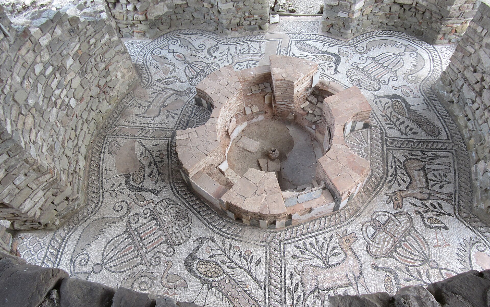
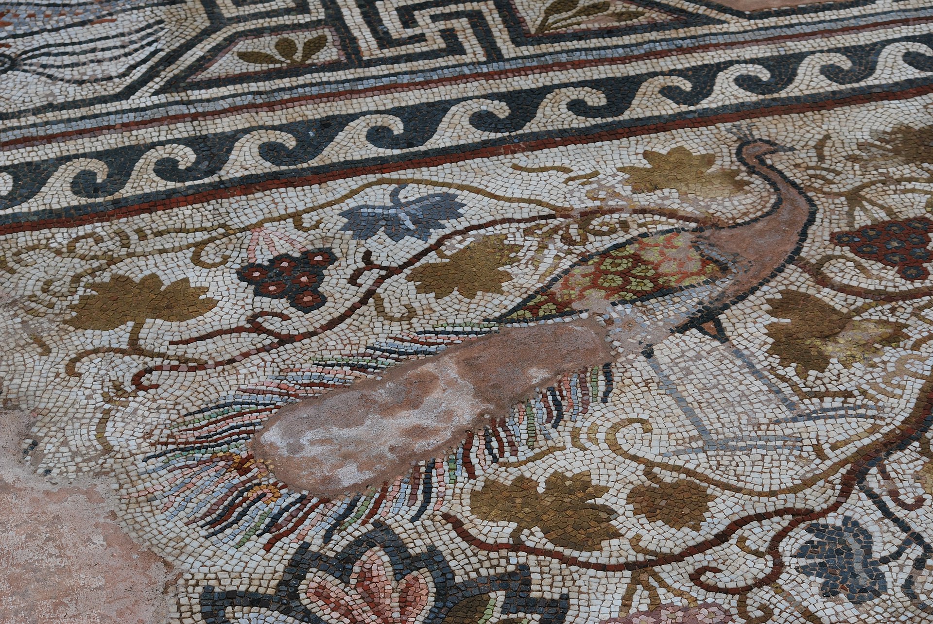
The decline was abrupt and well documented: sacked by the Ostrogothic king Theodoric in 479, struck by a major earthquake in 518, and finished economically by Avaro-Slavic incursions in the 6th century. The Museum of Belgrade excavated the site from 1924 to 1936, uncovering the 3rd-century theatre; work formally ended in 1940. Later campaigns found 55 graves between the North and Central Basilicas in 1970 and 23 Slavic burials of the 9th–12th centuries in 1955. The floor mosaics of the Episcopal Basilica and its baptistery — peacocks, deer, geometric borders — are the reason most visitors come. See our site profile of Stobi for the excavation record in detail.
Bylazora, near Knezhje in Sveti Nikole municipality, was the earlier Paeonian capital and the largest Paeonian town. Polybius explains its value: it commanded the pass from Dardania into Macedonia, which is why Philip V captured it in 217 BC.
Heraclea Lyncestis: Philip II’s Checkpoint on the Via Egnatia
Heraclea Lyncestis lies 2 km south of Bitola. Philip II of Macedon founded it in the middle of the 4th century BC, naming it for Heracles and siting it to block Illyrian incursions from the west into Macedon. Its long afterlife came from geography: the Via Egnatia, Rome’s main east-west road across the southern Balkans, ran straight through it.
Hadrian built the theatre on the hill at the town centre; it came into use under Antoninus Pius. The evidence chain here is unusually neat — a small bone seat ticket for row 14 of 20, found in 1931, proved a theatre existed decades before the structure itself was located in 1968. Three animal cages and a tunnel survive inside. The theatre fell out of use in the late 4th century AD as gladiatorial combat was suppressed. Heraclea then became a significant episcopal centre: Bishop Evagrius appears in the acts of the Council of Serdica in 343, Bishop Quintilinus at the Second Council of Ephesus in 449. Theodoric the Great sacked the city in 472, and it was abandoned during the 6th century after an earthquake and Slavic incursions. The three naves of the Great Basilica carry the floor mosaics that make Heraclea Lyncestis one of the best early-Christian mosaic sites in the Balkans.
Ohrid: The Region UNESCO Inscribed Twice
The Ohrid region is the only World Heritage property in North Macedonia, and its listing history is unusual. UNESCO inscribed Lake Ohrid in 1979 under a natural criterion. In 1980 the property was extended to take in the cultural and historical area of the town, adding three cultural criteria. In 2019 it was extended again to include the Albanian portion of the lake, making it transboundary. The town is one of the oldest continuously inhabited settlements in Europe and holds more than 800 Byzantine-style icons dated between the 11th and the end of the 14th century.
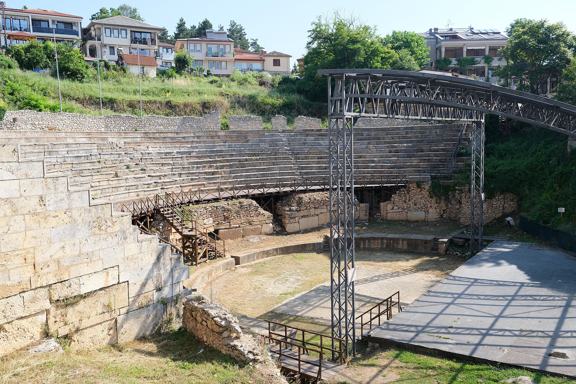
Three sites anchor a visit. The ancient theatre was built at the end of the 3rd or beginning of the 2nd century BC — conventionally c. 200 BC — and is the only Hellenistic-type theatre in the country; the three others, at Scupi, Stobi and Heraclea, are Roman. Two hills shelter it from wind, which is why its acoustics still work for the Ohrid Summer Festival. Plaošnik, 250 metres south of the citadel, is the archaeological and religious site associated with St Clement, who established his monastic school here in the 890s. Samuel’s Fortress above the old town served as the capital of the First Bulgarian Empire under Tsar Samuel at the turn of the 11th century; be aware that its battlements were heavily reconstructed in 2003 and much of what you see is new work on an old footprint.
Roman and Late Antique Skopje: Scupi, the Aqueduct and Kale
Scupi, between Zajčev Rid and the Vardar a few kilometres from modern Skopje, began as a Roman military camp founded in the 2nd century BC on an older Dardanian settlement. It became Colonia Flavia Aelia Scupi under Domitian (AD 81–96), settled largely with veterans of Legio VII Claudia, and served as the main engine of Romanization in Dardania. The Goths ravaged it in AD 269 and the Huns in the 5th century; the earthquake of 518 destroyed it outright, and the survivors are assumed to have moved onto the Kale hill.
That move explains Skopje Fortress. The first fortress on Kale was built in the 6th century AD, on ground already occupied in the Neolithic and Bronze Ages, using yellow limestone, travertine and reused blocks carrying Latin inscriptions — material quarried out of ruined Scupi. It is usually attributed to Justinian I and was rebuilt through the 10th and 11th centuries. Stefan Dušan was crowned emperor here in 1346. Evliya Çelebi described its double walls and five-sided plan in 1660.
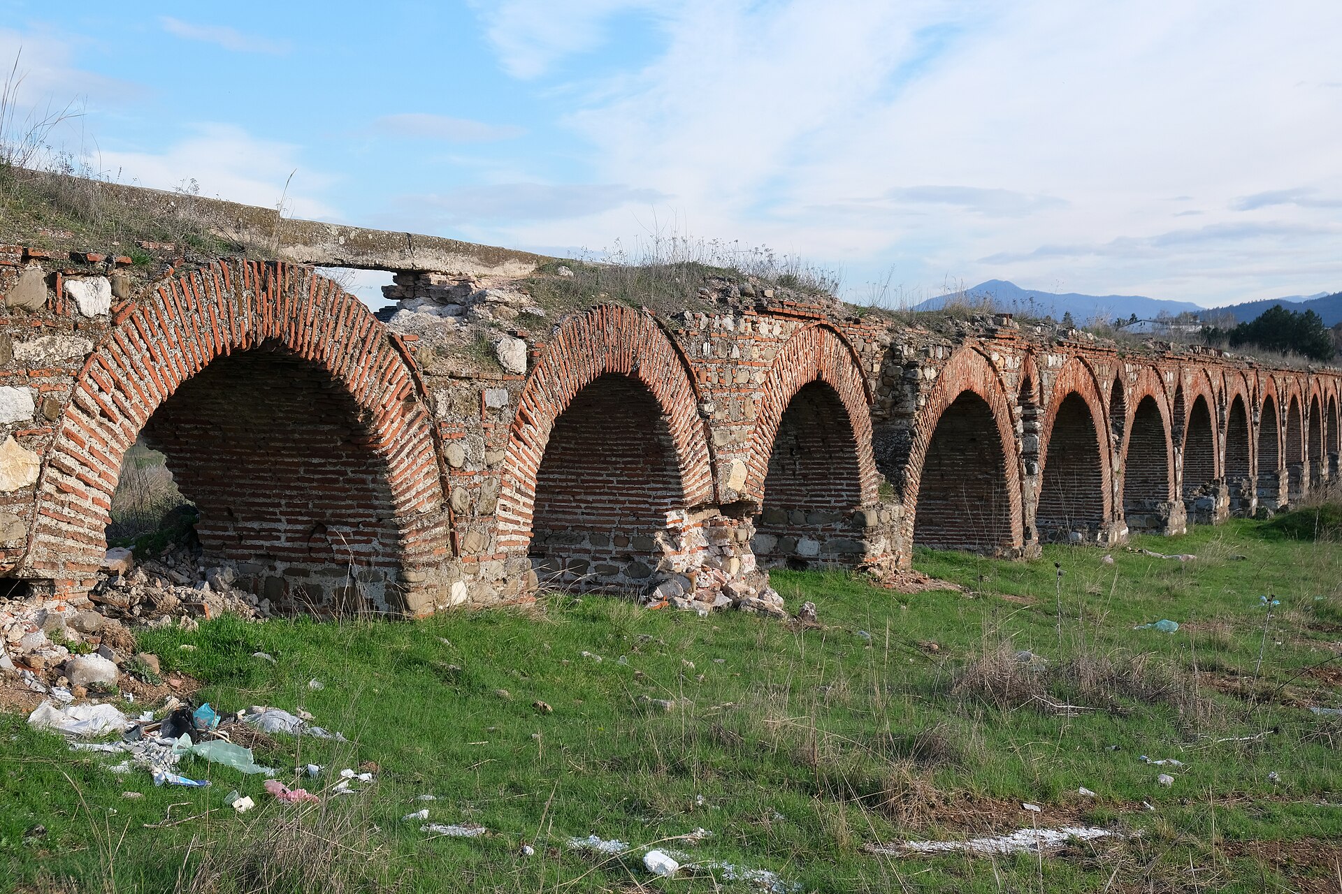
The Skopje Aqueduct at Vizbegovo, 2 km north-west of the centre, is the only aqueduct in the country. About 386 metres and 55 arches of stone and brick survive of a structure that probably drew water from the Lavovec spring, some 9 km away. Its date is genuinely unresolved — Roman 1st century, Justinianic 6th century and Ottoman 16th century have all been argued, and it stayed in use until the 18th. Restoration ran in phases from September 2021.
Bargala, Vinica and the Medieval Fortresses
Bargala sits 15.5 km east of Štip in Karbinci municipality, on the lower northern slope of Plačkovica. Its name is Thracian in origin, and an inscription at the site records the construction of the city gate in 371/372 AD. As a city of Macedonia Secunda it was the seat of a bishopric through the 4th and 5th centuries, with a basilica complex at its core and four further basilicas outside the walls; the bishopric survived to the end of the 6th century.
Viničko Kale, on a hill about 400 m above sea level near Vinica, was identified in 1954. In 1978 excavators recovered fragments of terracotta icons there — the finds that made the site nationally known — from a sequence running from the Neolithic through the Middle Ages.
Two medieval strongholds round out the list. Isar in Štip, between the Bregalnica and Otinja rivers, is an early medieval fortress whose surviving form is 14th century; some of its building material came from the ancient Paeonian town of Astibo, which Polyaenus mentions in the 2nd century BC. It passed under Bulgarian and then Serbian control before the Ottomans took it in 1382. Markovi Kuli, above the Varoš quarter of Prilep, stands on a granite hill 120–180 m high and is named for the Serbian prince Marko Mrnjavčević; it sits on North Macedonia’s UNESCO tentative list.
Planning a Visit
Stobi is the easiest major site to reach, immediately off the E75 between Skopje and Gevgelija. Heraclea is a short taxi ride from Bitola. Ohrid’s theatre, Plaošnik and Samuel’s Fortress are all walkable from the old town and can be done in a single morning. Kokino needs a car with decent clearance and is best in spring or autumn — the ridge is exposed and there is no shade. Fees, where charged, are modest; several sites, including Kokino, have no ticket office at all. Mosaics at Stobi and Heraclea are sometimes covered with protective sand or sheeting outside the main season, so check locally before travelling specifically to see them. More country guides are collected under Historical Places.
Sources and Further Reading
- UNESCO World Heritage Centre — Natural and Cultural Heritage of the Ohrid region
- Kokino — discovery, dating, and the disputed observatory interpretation
- Stobi — Paeonian origins, Roman municipium status, and excavation history
- Heraclea Lyncestis — foundation by Philip II and the theatre evidence
- World History Encyclopedia — Via Egnatia
- History Hit — Historic Sites in North Macedonia