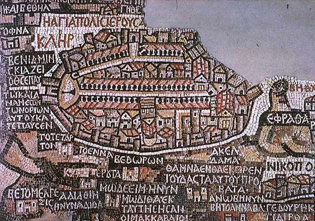
The Madaba Map, a significant artifact in the study of early Christian cartography, is one of the oldest surviving maps of the Holy Land. This mosaic map, discovered in the 19th century, offers invaluable insights into the geographical understanding and religious landscapes of the 6th century AD. It serves as both an artistic masterpiece and a historical document, reflecting the cartographic knowledge and religious devotion of its creators.
Get your dose of History via Email
Discovery and Context
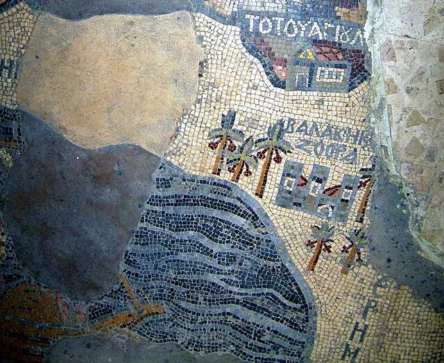
In 1884, the Madaba Map was uncovered in the town of Madaba, located in present-day Jordan. The map forms part of the floor of the Church of Saint George, a Byzantine-era basilica. It was likely created between AD 542 and 570, during a period when the region was part of the Eastern Roman (Byzantine) Empire. The map’s discovery provided a unique window into the world of Late Antiquity, specifically the Byzantine understanding of the Holy Land.
Structure and Content
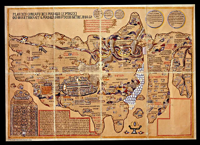
The Madaba Map is a mosaic, made up of millions of tesserae, or small colored stone and glass pieces. It originally measured about 21 by 7 meters, though only a portion of the map survives today. Despite its incomplete state, the map’s detail is remarkable.
It depicts a wide area, stretching from Lebanon in the north to the Nile Delta in the south, and from the Mediterranean Sea in the west to the Eastern Desert. The map centers on Jerusalem, which is depicted in great detail, reflecting its importance in Christian theology and pilgrimage. Notably, the map shows the layout of Jerusalem, including the Church of the Holy Sepulchre, which marks the site of Christ’s crucifixion and burial.
Other cities, towns, and religious sites are also represented, including Bethlehem, Jericho, and Hebron. The map includes detailed depictions of the Jordan River, the Dead Sea, and other significant geographical features. Many of these locations are labeled with Greek inscriptions, the language of the Byzantine Empire.
Theological and Cultural Significance
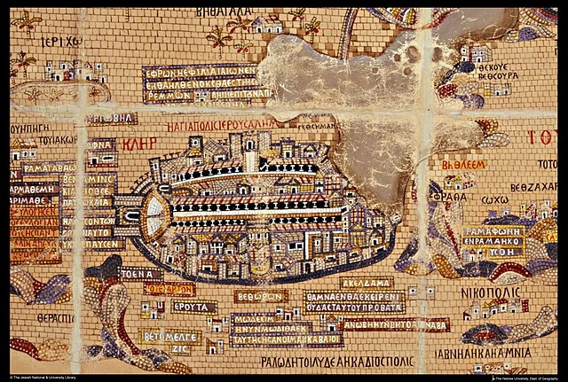
The Madaba Map is more than just a geographical tool; it is also a theological document. The map was likely used by Christian pilgrims as a guide to the Holy Land. It reflects the religious significance of the region, particularly the city of Jerusalem, during the 6th century AD.
The map also provides evidence of the Christianization of the Holy Land. Many of the sites depicted are associated with biblical events or Christian saints. This emphasis on Christian landmarks underscores the map’s role in the religious life of Byzantine Christians.
Moreover, the map offers insights into the cultural and political landscape of the period. The presence of Greek inscriptions and the depiction of cities and regions within the Byzantine Empire highlight the empire’s influence over the region.
Historical and Archaeological Importance
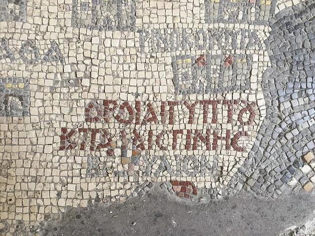
The Madaba Map is an essential resource for historians and archaeologists studying the early Christian period in the Middle East. It provides a visual representation of the Holy Land during the 6th century AD, offering clues about the region’s geography, settlement patterns, and religious sites.
The map has also been instrumental in identifying and verifying the locations of ancient sites. For example, the map helped archaeologists locate the ruins of Ascalon and the Nea Church in Jerusalem, both of which were previously lost to history.
In addition, the Madaba Map is an example of Byzantine mosaic art. Its detailed depictions and intricate craftsmanship reflect the high level of artistic skill that existed in the Byzantine Empire during this period.
Preservation and Legacy
Today, the Madaba Map is preserved within the Church of Saint George, where it continues to attract scholars and visitors from around the world. Efforts have been made to conserve the map, ensuring that it remains a valuable resource for future generations.
The map’s legacy extends beyond its physical preservation. It has become a symbol of the historical and cultural richness of the region. For scholars, the Madaba Map remains an important tool for understanding the history of the Holy Land and the broader Byzantine world.
Conclusion
The Madaba Map stands as a testament to the geographical knowledge, religious devotion, and artistic achievements of the Byzantine Empire. Its discovery has provided a wealth of information about the Holy Land in the 6th century AD, offering insights into the region’s religious, cultural, and political landscape. As both a work of art and a historical document, the Madaba Map continues to be a subject of fascination and study for historians, archaeologists, and theologians alike.
Source:

