Geography and Historical Background of Kızkalesi
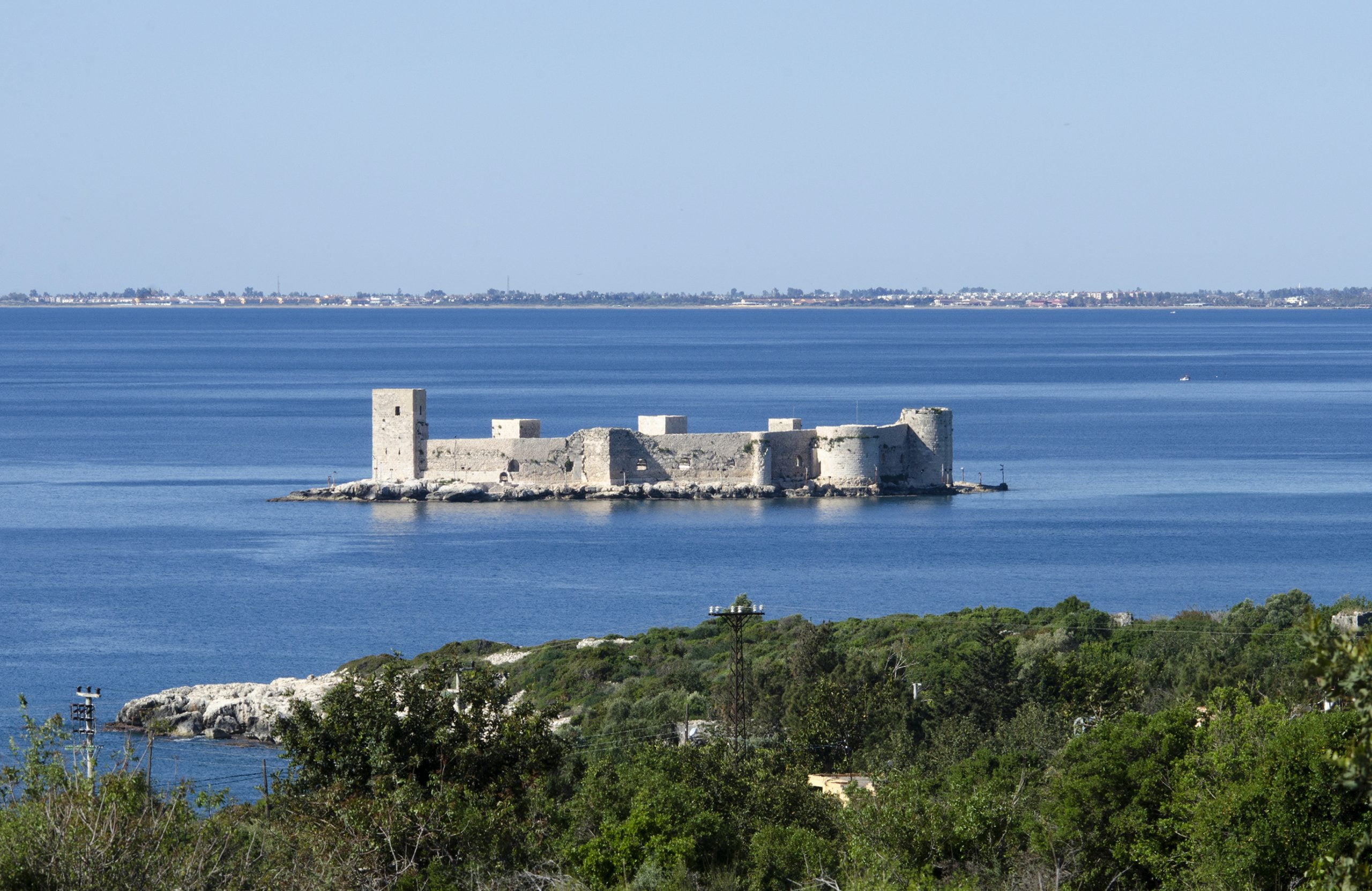
Kızkalesi, known in English as Maiden’s Castle, is a historical fortress located on a small island in the Mediterranean Sea, within the Mersin Province of Turkey. The island, originally named Crambusa (Greek: Γραμβούσσα, Gramvoussa), is positioned at coordinates 36°27′23″N 34°08′53″E. It lies approximately 300 meters off the shore and spans an area of about 15,000 square meters, with the castle occupying the majority of this space. The nearby town of Kızkalesi, sharing its name with the island, is situated 23 kilometers from Erdemli and 60 kilometers from Mersin.
Get your dose of History via Email
Historical Significance
The strategic importance of the island dates back to ancient times when it was reportedly used by pirates, as mentioned by the geographer Strabo. The initial construction of the castle is attributed to Alexios I Komnenos of the Byzantine Empire, following the First Crusade. Substantial modifications and expansions were carried out in the 13th century by Leo I and possibly other monarchs of the Armenian Kingdom of Cilicia. Archaeological findings from 1982 and 1987 reveal that the original Byzantine structure, characterized by square towers, is primarily preserved on the southern side of the castle. The Armenians are credited with reconstructing the northern and western sides, introducing round towers and rusticated ashlar masonry. Notably, two Armenian inscriptions reference renovations undertaken by King Leo I in 1206 and King Het‛um I in 1251. Additionally, a barrel-vaulted chapel constructed by the Armenians is located within the fortress.

The island was historically linked to the mainland fort, Corycus castle, by a breakwater. The Armenians referred to this fortress as Gorygos (Կոռիկոս). By the 14th century, the Cilician Kingdom was nearing collapse, and in 1360, Peter I of Cyprus seized the island following a request from its inhabitants. Subsequent captures include those by İbrahim II of Karaman in 1448 and Gedik Ahmet Pasha of the Ottoman Empire in 1471, after which the name Gorygos was changed to Kızkalesi.
Architectural Description
The castle’s ramparts extend to a total length of 192 meters, with the south and west walls forming a perpendicular angle. The north and east sides are encircled by a curved rampart. The main entrance is located on the northern side, complemented by a minor gate and a gallery on the west. The fortress features eight bastions, each with a distinct shape. Between 1973 and 1981, an extensive photographic survey, including plans of the two fortresses at Kızkalesi, was conducted.

Legend of Kızkalesi
A notable legend associated with Kızkalesi tells of a king who, upon learning from a fortune teller that his daughter would die from a snake bite, decides to protect her by constructing a castle on the snake-free island. Despite his efforts, the princess meets her fate when a snake, hidden in a basket of grapes from the mainland, bites her. This tale, reflecting the themes of fate and the inevitability of destiny, is not unique to Kızkalesi but is shared by other localities in Turkey.
Kızkalesi stands as a testament to the rich historical tapestry of the Mediterranean region, embodying the architectural and cultural influences of the Byzantine Empire and the Armenian Kingdom of Cilicia. Its strategic location, architectural complexity, and the enduring legend of the Maiden’s Castle continue to captivate scholars and visitors alike.
Sources:

