The Tombs of the Kings of Pontus: An Archaeological Overview
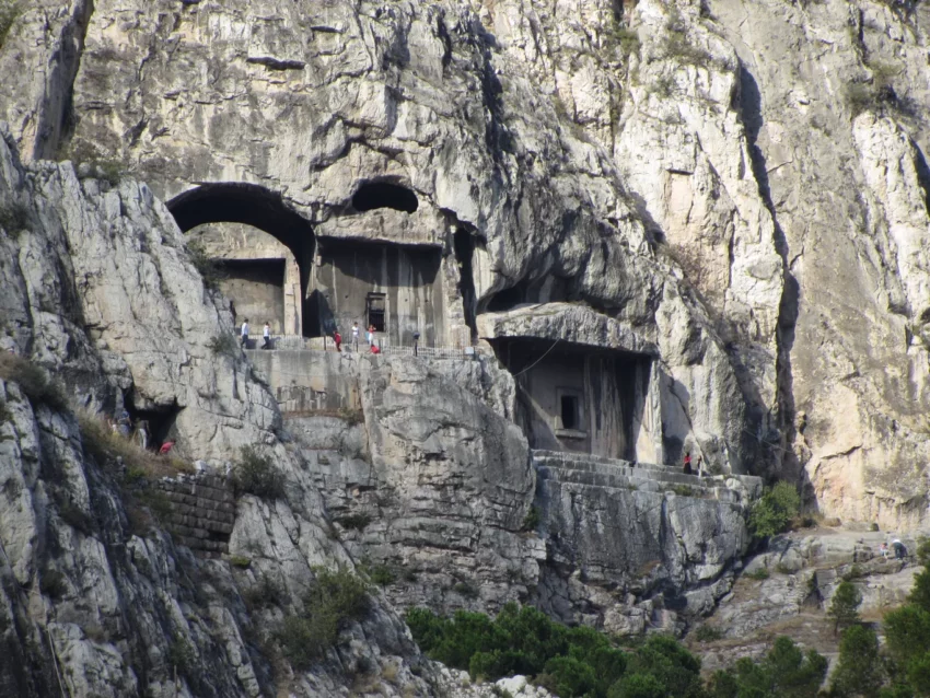
The Tombs of the Kings of Pontus are in Amasya, northern Turkey. These rock-carved tombs form the royal necropolis of the Pontic kings. UNESCO added the site to its tentative list in April 2014 and inscribed into the list of UNESCO world heritage sites in 2023.
Get your dose of History via Email
Geographical Context
The royal necropolis lies on the southern hillside of Mount Harşena. This mountain stands 272 meters high, north of Amasya and the river Yeşilırmak. The tombs are carved in limestone rock. Mithridates I, who reigned from 281 to 266 BC, established the Kingdom of Pontus. He made Amaseia, now Amasya, the capital city. The tombs contain large stone grave chambers. The area is called the “Valley of the Kings” due to the kingdom’s size and its historical significance.
Historical Inhabitance and Civilizations
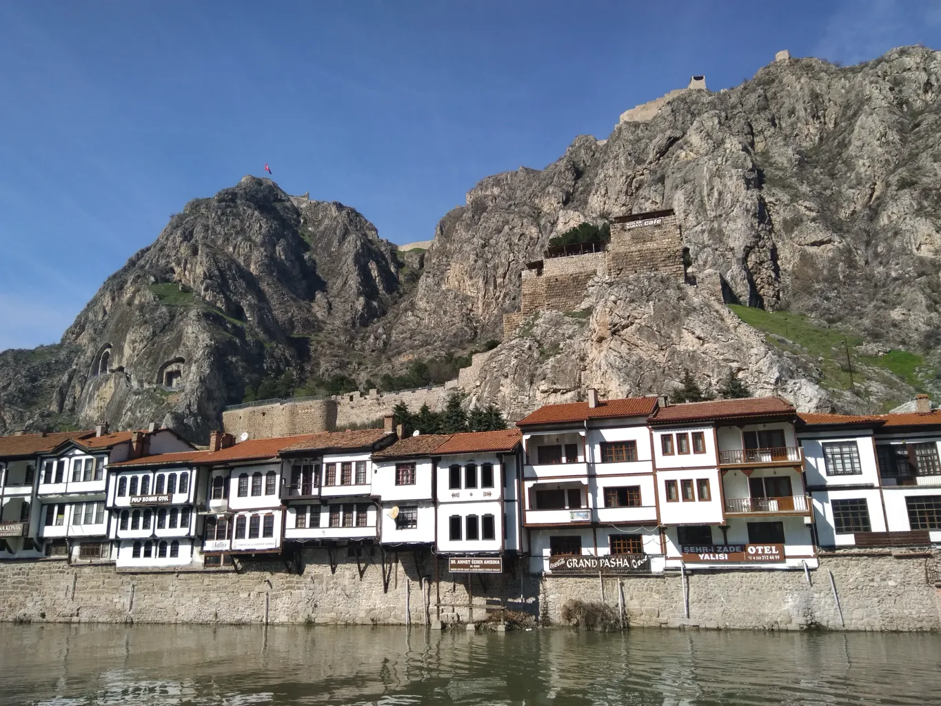
Mount Harşena and Amasya Fortress have been inhabited for over five thousand years. This period spans from the Early Bronze Age to the end of the Ottoman Empire. Many civilizations have lived in this area. These include the Hittites, Phrygians, Cimmerians, Scythians, Medes, Persians, Pontic Kingdom, Romans, Eastern Romans, Danishmends, Anatolian Seljuks, Ilkhanids, Eretnids, and Ottomans.
Establishment of the Pontic Kingdom
In 301 BC, the Persian Satrap Mithridates I Ktistes established the Pontic Kingdom. He made Amaseia the capital city. Under Mithridates VI Eupator, the kingdom expanded. Its lands reached the current borders of Turkey, Russia, Ukraine, Georgia, Armenia, Bulgaria, and Greece. During this period, Mount Harşena and Amasya Fortress saw significant development. The walls around the fortress and the monumental rock-tombs of the Pontic Kings were built.
The Defeat of Pharnakes II
Pharnakes II, the son of Mithridates VI, faced defeat by the Roman General Caesar in 47 BC. This occurred during the Zela (Zile) War. After the war, Caesar famously said, “veni, vidi, vici” (“I came, I saw, I conquered”).
Ottoman Control and Administrative Role
In 1386, Amasya fell under Ottoman control. The city remained an administrative center during the Ottoman period. Its strategic location at the eastern borders was crucial. In 1402, Amasya was organized as the Shahzade District. Twelve shahzades served in the city, and seven ascended the throne.
Amasya Fortress: Structure and Features
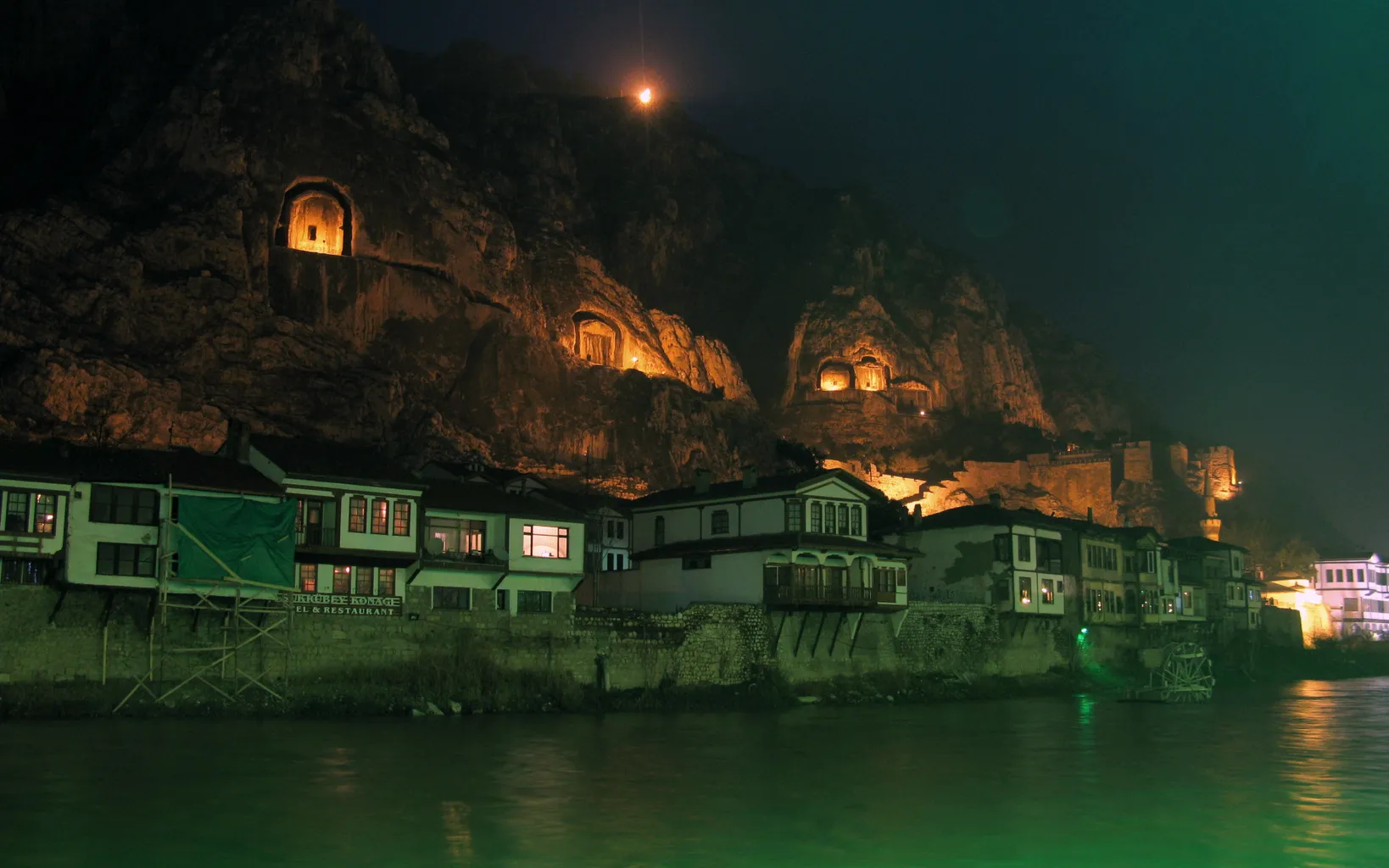
Amasya Fortress, also known as Harşena Fortress, has undergone many renovations. It has three main sections and eight levels of defense. The fortress walls, approximately two kilometers long, were built in different historical periods. The fortress includes cisterns, a Dungeon Tunnel, and ruins of an Ottoman Period neighborhood. There are also believed to be three underground churches from the Eastern Roman Period.
Middle Fortress and Maiden’s Palace Area
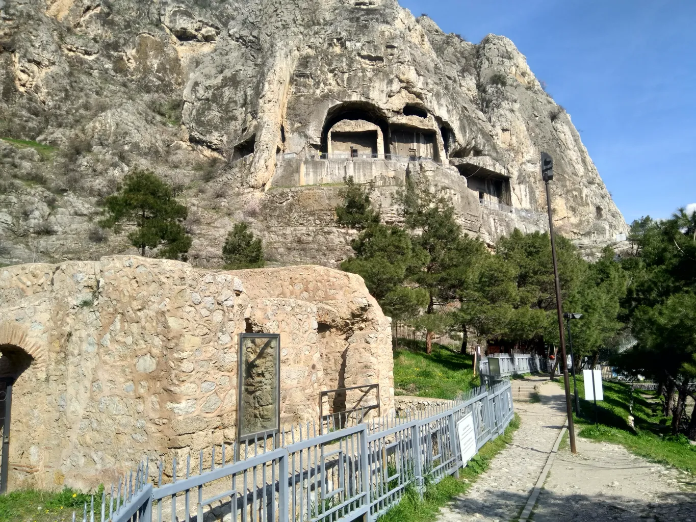
The Middle Fortress is located on the southern slopes of Mount Harşena. It lies below Amasya Fortress. This area includes five monumental rock-tombs of the Pontic Kings. It also has two Ottoman public baths from the 14th and 15th centuries AD. Other features include the Maiden’s Palace Ceylan Road, Cilanbolu Cistern, Ceylan Tunnel, and Hellenistic period fortress walls.
Architectural Features of the Rock-Tombs
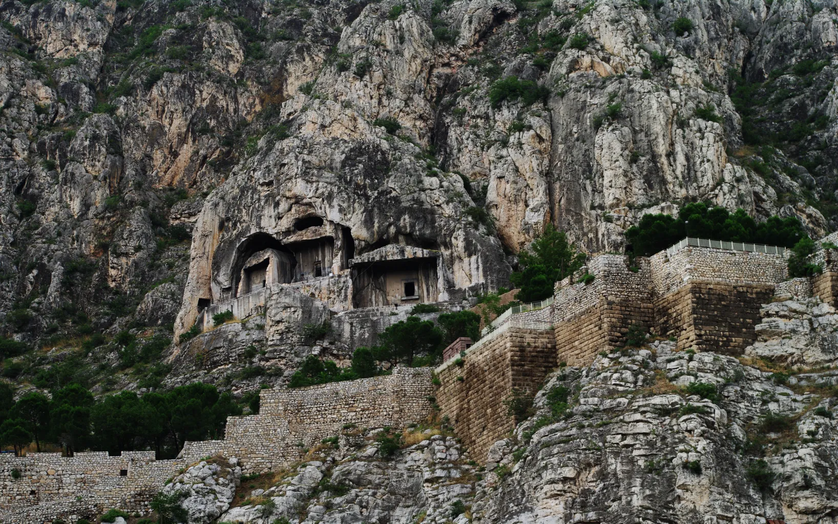
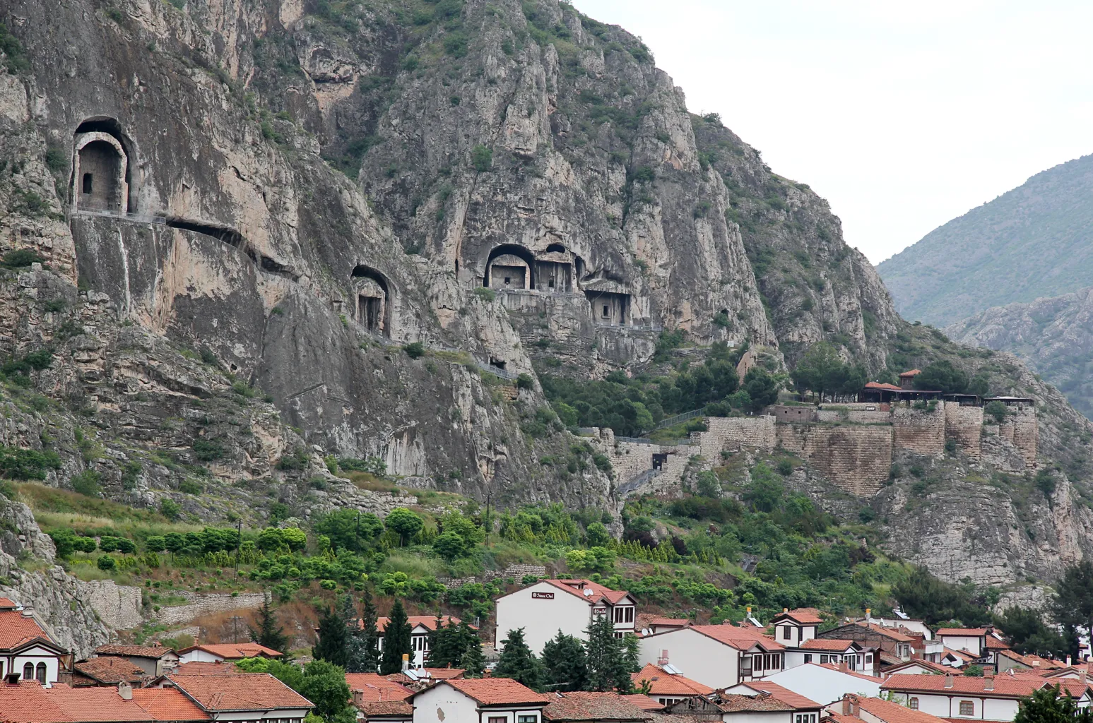
The rock-tombs at the Royal Necropolis range from 8 to 15 meters in height. There are two groups of tombs, starting from the right side, I to V. Tombs I, II, and III are in the east, near the Hellenistic walls. Tombs IV and V are in the west. Tomb I is accessible by a staircase cut into the rock. Another staircase leads to tombs II and III. A tunnel continues to the northwest. From its end, one can climb to the acropolis or walk to another tunnel leading to tomb IV. A gallery-like staircase leads to tomb V.
Construction and Design
The tombs were planned to have surrounding corridors. This design aimed to give the impression of free-standing buildings. However, only the corridors of tombs II, III, and IV were completed. Work on the corridors of tombs I and V was abandoned. This was due to the crumbly rock and Pharnakes I’s decision to move the capital to Sinope.
The Largest Tomb: Pharnakes I
The largest tomb belongs to Pharnakes I. It measures 15 meters by 8 meters by 6 meters. An inscription above this tomb reads, “the phrourarch Metrodorus dedicated an altar and a flower-bed for the king Pharnakes I to the gods.” Steps in the rock, now partially visible, led to this place. The development of Pontic rock-tombs ceased when Pharnakes I moved the capital to Sinope.
Inner Fortress and Historical Buildings
The Inner Fortress, also known as Enderun Fortress, has eight terraces parallel to the mountain. It lies between the Maiden’s Palace area and the fortress walls along the Yeşilırmak River. The Hatuniye Neighborhood, with historical buildings over two hundred years old, is in this area. These buildings have traditional Ottoman architectural features. The area also includes the Yalıboyu Houses, constructed in the mansion form. There are also remains of the Hittite period underground.
Sources:

