Caracol: A Comprehensive Overview of the Ancient Maya City
Introduction
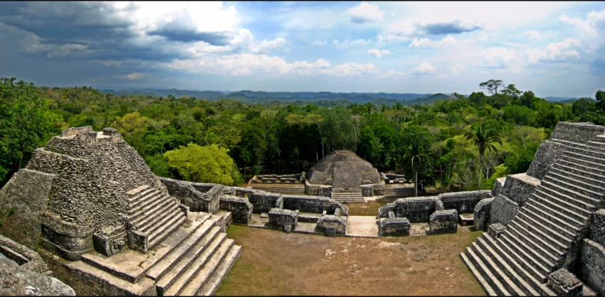
Caracol is a significant ancient Maya archaeological site located in the Cayo District of Belize. Positioned approximately 40 kilometers south of Xunantunich and the town of San Ignacio, and 15 kilometers from the Macal River, it occupies the Vaca Plateau at an elevation of 500 meters above sea level. Initially thought to be a tertiary center, Caracol emerged as one of the most crucial regional political centers in the Maya Lowlands during the Classic Period. The site spans roughly 200 square kilometers, surpassing the area of present-day Belize City and supporting a population more than twice its size.
Get your dose of History via Email
Etymology
The name “Caracol” derives from the Spanish word for “snail” or “shell,” likely referring to the site’s spiral-shaped access road.
Discovery and Exploration
Rosa Mai, a native logger, discovered Caracol in 1937 while searching for mahogany. The site was reported to the archaeological commission of British Honduras (now Belize), leading to its initial documentation and naming by A. Hamilton Anderson in 1938. Subsequent explorations, particularly by Linton Satterthwaite and the University of Pennsylvania Museum of Archaeology and Anthropology, laid the groundwork for understanding Caracol’s significance. The Caracol Archaeological Project, initiated in 1983 and directed by Arlen and Diane Chase, has been instrumental in uncovering the site’s extensive urban and agricultural networks, primarily through annual excavations and a groundbreaking LiDAR survey in 2009.
Population and Infrastructure
Caracol’s population density and urban planning were remarkable, with approximately 267 structures per square kilometer. The city’s layout, characterized by equidistantly situated structures integrated with an extensive terrace system, facilitated a population exceeding 100,000 at its peak. The LiDAR survey revealed an intricate network of causeways, residential groups, and agricultural terraces, underscoring Caracol’s sophisticated socio-economic organization.
Historical Significance
Occupation at Caracol dates back to as early as 1200 BC, with the epicentral area becoming active around 650 BC. The site flourished during the Classic Period (AD 250–950), engaging in extensive trade networks and experiencing periods of warfare and prosperity. Notably, Caracol’s military campaigns against Tikal and Naranjo marked significant episodes in its history, contributing to its regional dominance. The construction of Caana, the largest building at Caracol and the tallest man-made structure in Belize, symbolizes the city’s architectural and political zenith.
Collapse and Legacy
Despite Caracol’s resilience during the initial phase of the Maya collapse, the site eventually experienced a decline in symbolic egalitarianism and a shift in elite material culture. The last recorded date at Caracol is AD 859, with the site’s abandonment around AD 900. However, Caracol’s extensive urban planning, monumental architecture, and the wealth of inscriptions left behind continue to provide valuable insights into ancient Maya civilization.
Conclusion
Caracol stands as a testament to the complexity and dynamism of Maya society. Its extensive urban sprawl, sophisticated agricultural practices, and the pivotal role in regional politics highlight the advanced socio-political and economic systems of the ancient Maya. Ongoing archaeological investigations promise to further unravel the mysteries of this remarkable city, contributing to our understanding of Maya civilization’s breadth and depth.
Sources:
Wikipedia

